

DENVER — A new series of storms will bring heavy snow back to the mountains tonight and Wednesday. Denver and the eastern plains will mainly see an increase in clouds and slightly cooler weather.
The mountains will have moderate to heavy snow developing Tuesday night into Wednesday morning. Most ski areas will receive 4 to 8 inches of snow from this next storm system, although up to a foot of snow may fall at Steamboat and over the southwestern mountains.
Denver and the eastern plains will miss most of the moisture with this storm with just increasing clouds expected tonight.
Lows will be in the teens in the mountains and middle 20s to low 30s for lower elevations.
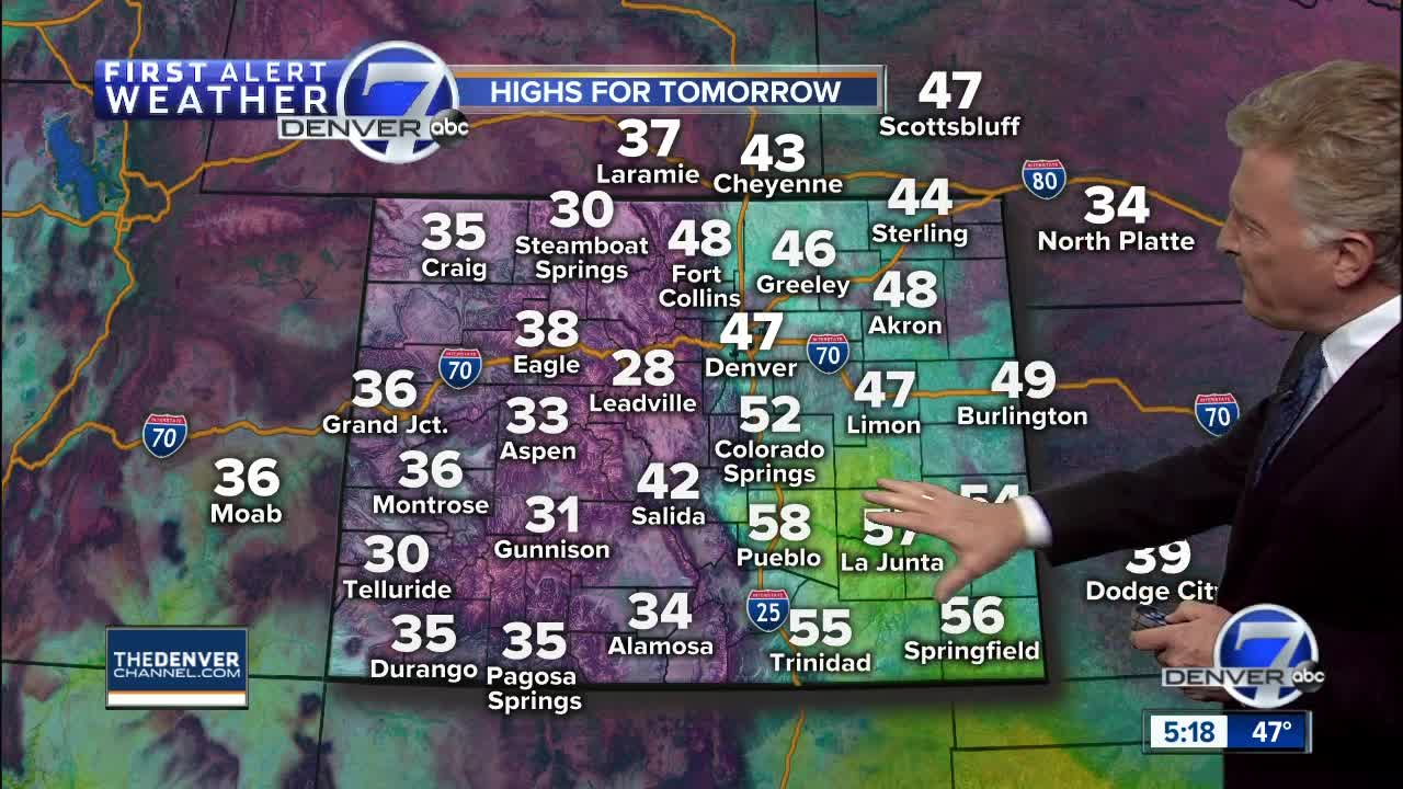
Some light rain showers or flurries will be possible across eastern Colorado on Wednesday with highs in the mid to upper 40s under a mostly cloudy sky. In the mountains, another 2 to 4 inches of snow will be possible, although the amounts will be rather hit and miss as the main energy of the storm moves out of the state.
Thursday will be mild and dry ahead of the next storm system. Highs will be in the 50s on the plains with 30s in the mountains.
A stronger storm will bring more snow to the high country and plains Thursday night and Friday. This storm should bring 6 to 12 inches of snow to the mountains and perhaps one to three inches to the plains. It will not be as big a snow-maker for the Denver area as the one that hit late last week.
The weekend will be cool, but relatively quiet with just a few snow showers possible in the mountains. Another storm should arrive next Tuesday and Wednesday with more heavy mountain snow and a chance for light snow in Denver.
By later next week, a strong Arctic cold front will bring much colder weather to most of Colorado.
