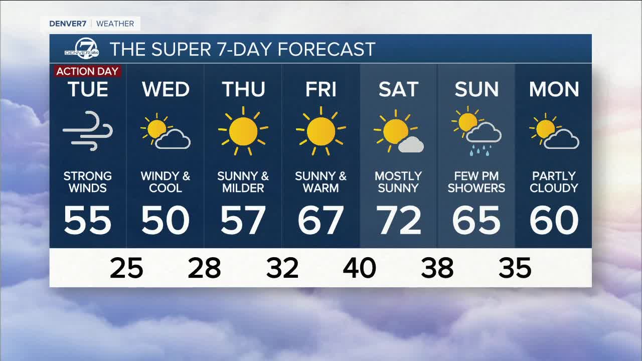


A Denver7 Weather Action Day is in effect for Tuesday as strong winds are expected across much of the state.
Monday has been delightful with sunny skies and mild temperatures, that will change overnight and Tuesday as a cold front sweeps into the state from the west. This front will be accompanied by 5 to 10 inches of snow for the mountains and some rain showers for Denver and the eastern plains. A Winter Weather Advisory is in effect for the northern and central mountains through Tuesday.
The biggest feature of the front will be powerful winds that will roar from the mountains, through Denver and across eastern Colorado. A High Wind Warning is in effect for the Front Range foothills west of I-25 and for some of the western suburbs close to the foothills. This warning runs from 6 PM Monday through Tuesday morning. Westerly wind gusts of 60-80 mph will develop later tonight and continue Tuesday morning.
Farther to the east, Denver and all of the eastern plains can expected some rain showers, cooler temperatures and very strong winds of 40-60 mph on Tuesday as the cold front races to the east.
Wednesday will be cool and still pretty windy with highs in the upper 40s to low 50s for Denver and the eastern plains. The mountains will have lingering snow showers, gusty winds and highs in the middle 30s to lower 40s.
Thursday will be sunny and milder with highs in the upper 50s. Friday will be dry and warm - perfect for the Rockies home opener at Coors Field with highs in the upper 60s and plenty of sunshine.
Saturday will be mostly sunny and warm with highs in the low 70s. On Sunday, clouds will increase and a few afternoon showers will be possible. Highs will be in the middle 60s.
Click here to watch the Denver7 live weather stream.
