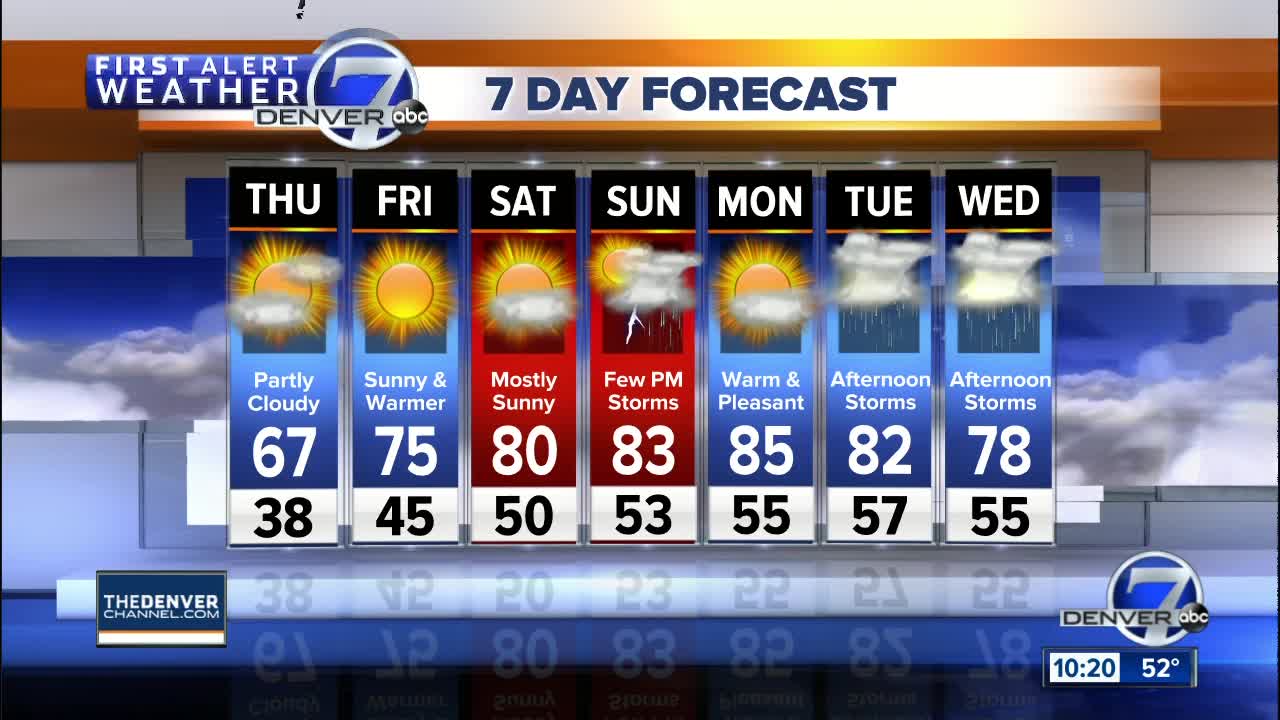
DENVER — The cool and stormy weather pattern is finally on the way out of Colorado! A nice warming trend will now develop over the central Rockies!
MORE|Interactive Radar| Forecast | Weather page | Traffic conditions
Skies will be clearing across eastern Colorado early tonight. Rain and snow showers will linger in the mountains early, but skies will become partly cloudy by morning.
It will be a chilly night with lows dropping to the upper 30s in the Denver area and across northeast Colorado. In the mountains, lows will dip to the middle 20s to around 30 degrees.
The cool weather will move away from Colorado on Thursday with partly cloudy skies and highs back in the mid to upper 60s in Denver and the middle 40s to low 50s in the mountains. There will be some scattered rain and snow showers in the mountains and foothills and a few rain showers may pop up along the I-25 Corridor in the afternoon. The plains will remain dry.
Warmer weather will cover Colorado for the first weekend of June! Temperatures will rebound back into the 70s on Friday and 80s Saturday and Sunday. The warm weather will last into the start of next week.
Rain chances will be fairly low over the weekend into early next week as no major weather disturbances will be moving across Colorado. There is always a slight chance for afternoon thunderstorms in early June, especially thanks to the moisture that now exists in our soil. The best chance of seeing scattered afternoon storms will be Sunday.
Monday will be warm and mainly dry, but a more organized storm system will arrive next Tuesday and Wednesday with a better chance for thunderstorms.
Current Conditions
- Humidity: 25%
- Dew point: 16°
- Pressure: 30.04 in
- Wind speed: 3 mph
- Wind direction: SE
- Visibility: 10.0 mi
- Sunrise: 06:33 AM
- Sunset: 04:53 PM


