A northwesterly JET STREAM flow will whisk storm systems across the northern plains, across the Great Lakes to the East Coast over the next few days. Colorado will be too far to the south of this storm track to get more than a few mountain snow showers, but there will be some cold fronts zipping across the state.
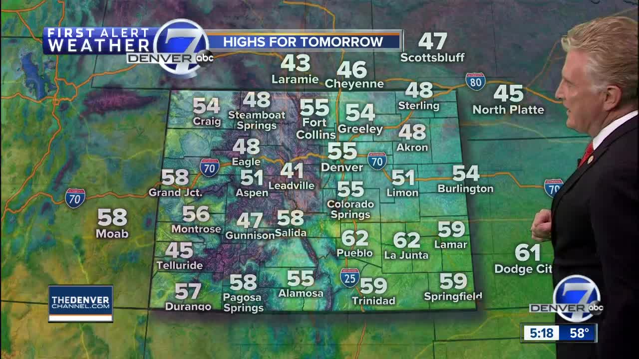
A cold front will move through the state tonight and early Wednesday with cooler temperatures and gusty winds. Denver and the plains will stay dry, but winds will be strong from the northwest on Wednesday with speeds of 15 to 35 mph. Highs will be in the low to mid-50s in Denver, with mid to upper 40s over northeastern Colorado. The wind will make it feel colder!
Thursday will not be as windy, but will remain a little cool with highs in the upper 40s to low 50s for Denver and the northeast plains. The mountains will have dry weather with sunshine and temperatures in the 40s.
Friday will be warmer with highs back into the upper 60s in Denver and upper 40s to middle 50s in the mountains.
Another cold front will move into Colorado Saturday afternoon. Clouds will increase and there may be some rain and snow showers developing late in the day. Highs will be in the middle 50s. A few inches of snow may fall in the northern and central mountains Saturday night, with some flurries possible in the Denver area.
Skies will clear on Sunday with highs in the lower 50s. Monday and Tuesday should stay dry and mild with highs in the low 60s.
The jet stream pattern should shift a bit farther to the south in the next seven to 10 days and become more active through the end of November with a better chance for snow.


