


Another mild day for the Front Range on Thursday afternoon with highs in the low 50s for the day. We officially hit 51 degrees at the airport for Thursday.
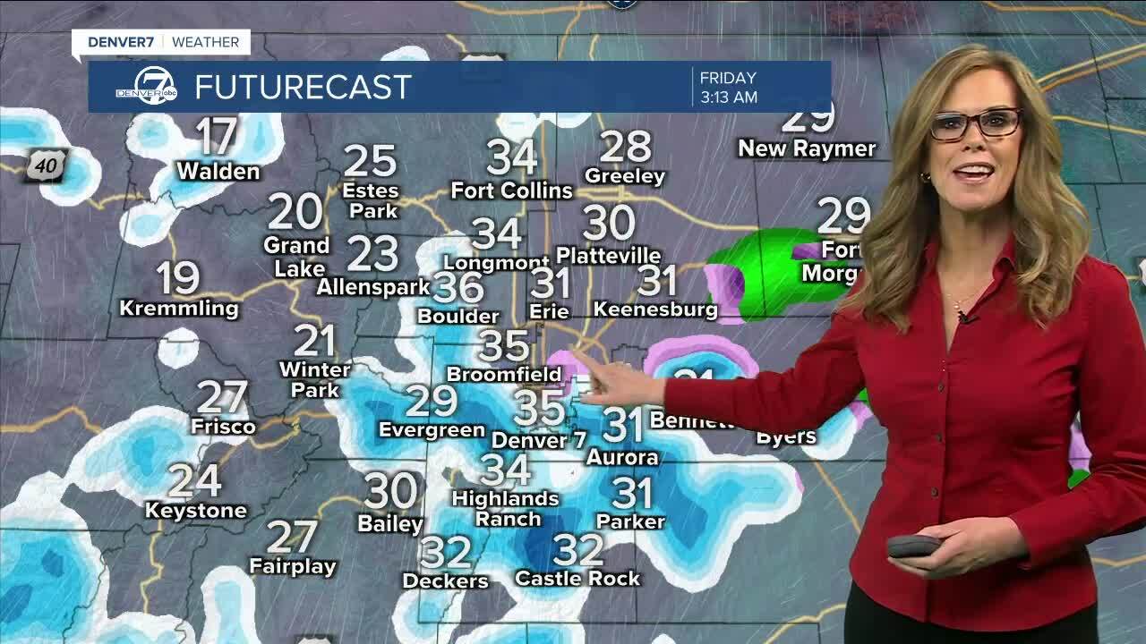
Snow will develop in the southern mountains Thursday and continue through Friday. We'll see some light snow overnight along the I-25 corridor, with some of the slickest conditions expected from Castle Rock south toward Colorado Springs where we could see 1 to 2 inches of snow.
For metro Denver we are expecting very light snow, which will keep our accumulation levels around 1/2 inch or less. If you are driving in the high country you might run into slippery conditions on Friday.
Areas north of I-70 (Greeley to Ft. Collins to Sterling) shouldn't expect to see much if any snow- as this system will keep most of the energy south.
It looks like the snow will be completely move out of metro Denver by the afternoon on Friday.
Skies clear for the weekend and warmer and drier weather will settle back in.
Looking ahead to next week, temperatures are expected to be well above average, soaring to the upper 50s to even low 60s Monday through Wednesday - feeling more like Spring-time!
LEARN MORE: Hourly forecast | Radars | Traffic | Weather Page | 24/7 Weather Stream
Click here to watch the Denver7 live weather stream.
