


DENVER — The Arctic air mass that has gripped Colorado and much of the northern United States will continue to have us in it's icy grip through tonight. Some light to moderate snow can be expected over the mountains and foothills with 2 to 4 inches possible. The Denver area will see less than an inch of snow, but temperatures will drop to zero to 5 below by Tuesday morning.
The Denver7 Weather Action Day will remain in effect through 7 AM Tuesday due to the very cold temperatures and the possible slick streets and sidewalks through the early morning commute.
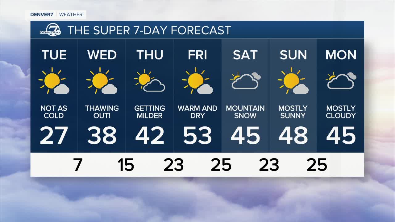
The Arctic air will ease up over Colorado starting Tuesday as the coldest air slips off to the east of Colorado. Some of the really cold air will remain trapped in the high mountain valleys - such as the Fraser area, Gunnison, Steamboat Springs and Alamosa - so expect a few more days of really cold weather in those areas.
Denver and the eastern plains will begin to thaw out as the cold, dense air slides off to the east of our area. Highs on Tuesday will rebound into the upper 20s to low 30s. Wednesday will be in the upper 30s, Thursday in the 40s and finally Friday will have highs in the low 50s!
The snowy weather pattern will also come to an end for the mountains. Dry weather is expected this week in the high country with the next chance for snow not arriving until Saturday.
Click here to watch the Denver7 live weather stream.
