DENVER — A few flurries are possible across eastern Colorado Thursday evening, with some heavier snow out east near the Nebraska and Kansas borders. Skies will gradually clear, but temperatures will be about 15 degrees below normal.
Even with some afternoon sunshine, Thursday was the coldest day of the week. Highs climbed into the upper 30s to low 40s during the afternoon.
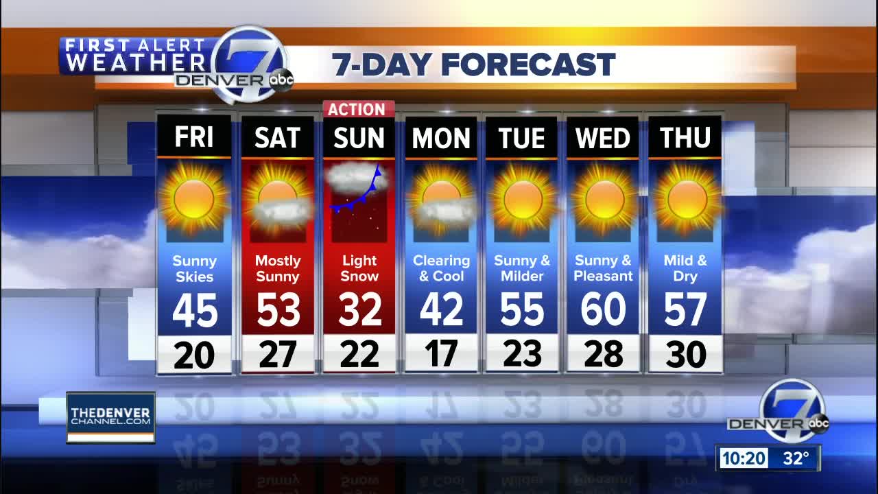
Skies will be clear on Friday with highs in the mid 40s. Saturday will be one of the warmest day this week, with highs in the low to mid 50s for Denver and the Front Range, and in the 30s to low 40s in the mountains.
Winds will pick up on Saturday ahead of our next front. You'll see gusty conditions, especially along the northern Front Range near Fort Collins and Estes Park.
This next cold front will arrive Saturday night and early Sunday with colder temperatures and a chance for snow for the mountains and the eastern plains, including Denver. It looks like we'll see highs near freezing on Sunday, with one to three inches of snow possible along the Front Range.
Be sure to download the STORM SHIELD APP to help keep you ahead of any stormy weather!


