


DENVER — Conditions are favorable for flooding in Colorado’s northern front range mountains with a particular threat in burn areas.
Pockets of heavy rain could also trigger isolated flooding in the Denver metro area, along the I-25 corridor and plains as afternoon storms fire this afternoon.
A flash flood warning remains in effect for the Cameron Peak burn scar area in Central Larimer County until 7:15 p.m.
Up to a half inch of rain has already fallen with flash flooding expected, according to the National Weather Service in Boulder.
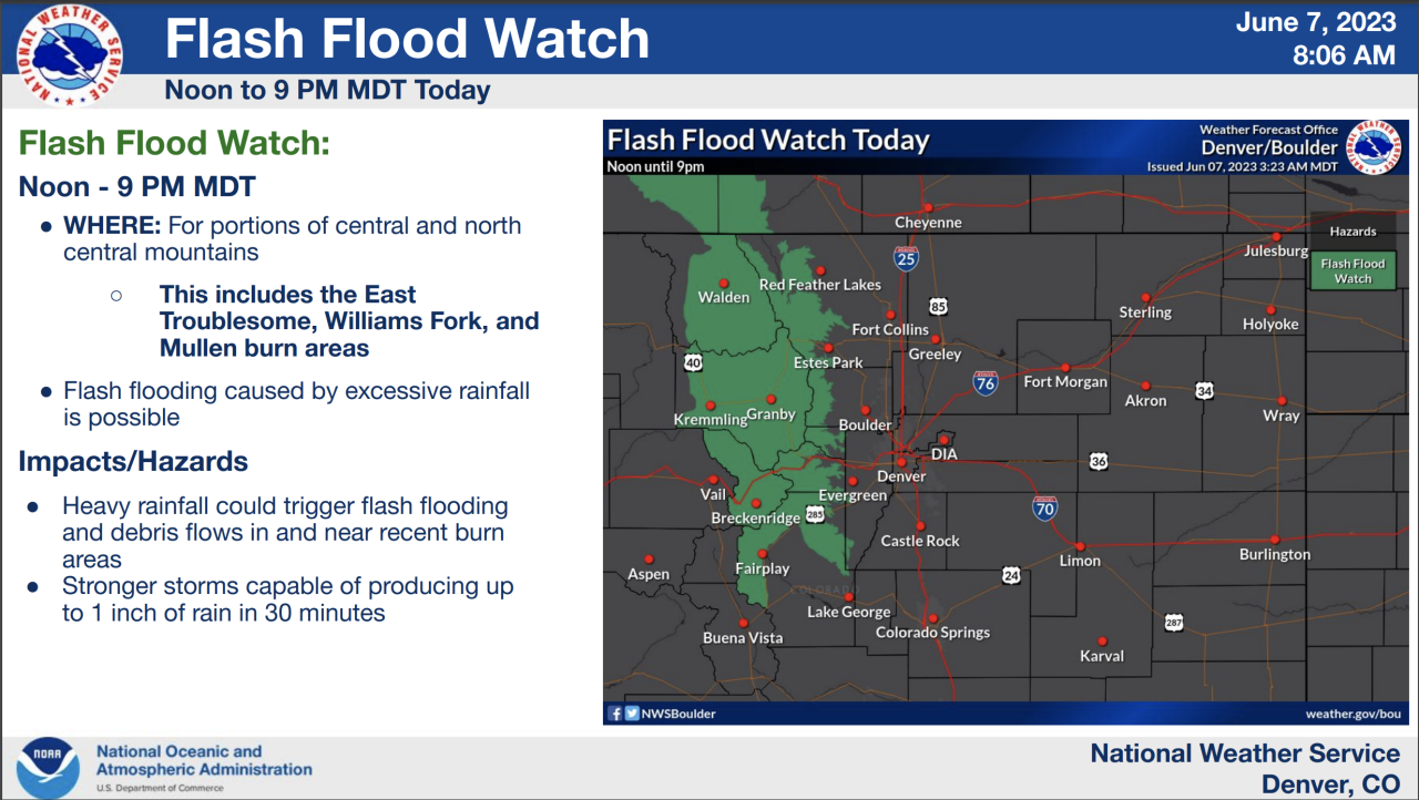
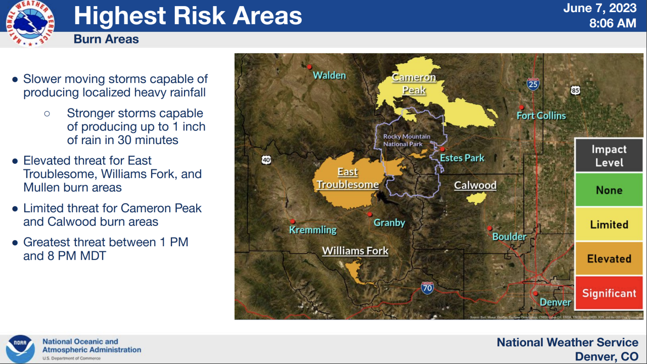
A flash flood watch went into effect at Noon through the evening hours Wednesday for the central and north central mountains including the East Troublesome, Williams Fork and Mullen burn areas, according to the NWS.
Widespread heavy rain, up to an inch could fall in 30 minutes triggering flash flooding and debris flow in the burn areas.
Check latest weather alerts for a full list of communities under the flash flood watch. Check Denver7's interactive radar here to track the storms.
As afternoon storms roll off the mountains across the metro area, small hail is possible in the Denver metro during the afternoon and evening commute hours, said Denver7 morning meteorologist Lisa Hidalgo.
Evening commuters should expect to see wet roads in the urban corridor and plains with these scattered showers. A few heavier storms could fire, bringing hail and higher wind gusts, the NWS said.
The greatest risk of flooding in the burn scar areas will be after Noon through 9 p.m. Wednesday.
The NWS warns residents near burn areas to stay weather aware and have a plan to seek shelter in case of flooding.
Wednesday’s high temperatures will reach the mid 70s in Denver which is slightly cooler than the average high of 80 degrees.
Looking ahead, storms stay in the forecast during the afternoon and evening hours each day into next week.
Wondering why Colorado see's this type of constant stormy pattern each afternoon?
Read our in-depth look at June weather in Denver.
June is a month that acts like summer most of the time but isn’t afraid to show its brooding spring-like contempt whenever it feels the need—and it usually delivers those punches in the form of thunderstorms and large hail.
Like most of spring, June is a transitional month.
It’s a month that lies between the cool rains of May and the warm rains of the monsoon season. Warm Gulf moisture will occasionally pick fights with cold fronts, creating periods of instability, thunderstorms, hail, and sometimes tornadoes.
The month can receive the most intense severe weather of the year, according to the National Weather Service. Tornado season heats up as well during June. But let’s get the stats out of the way.
June can be the most relentless month weather-wise for Denver. Severe thunderstorms with large hail, damaging wind gusts, heavy rain, and strong tornadoes are common during the sixth month of the year.
Colorado is entering peak tornado season. The state sees an average of 27 tornadoes during May and June, with June being the busiest month with an average of 17 tornadoes, according to the National Oceanic and Atmospheric Administration. There have been 2,125 tornado events recorded in Colorado and at least five deaths related to twisters since 1950.
