


DENVER — Heading into tonight, you can expect hazy and smoky skies to stick around for a bit longer, especially across the lower elevations. Conditions will be dry for metro Denver overnight with lows near 60 degrees.

Sunday is shaping up to be a bit more active, especially out east. Some of that smoke should start to clear as the winds shift a bit higher up in the atmosphere. We’ll see scattered showers and a few thunderstorms in the afternoon, and although most won’t be too intense, there's a chance that a couple storms over the far eastern plains could turn strong or even briefly severe. If you’re out that way, keep an eye on the sky during the late afternoon and evening.

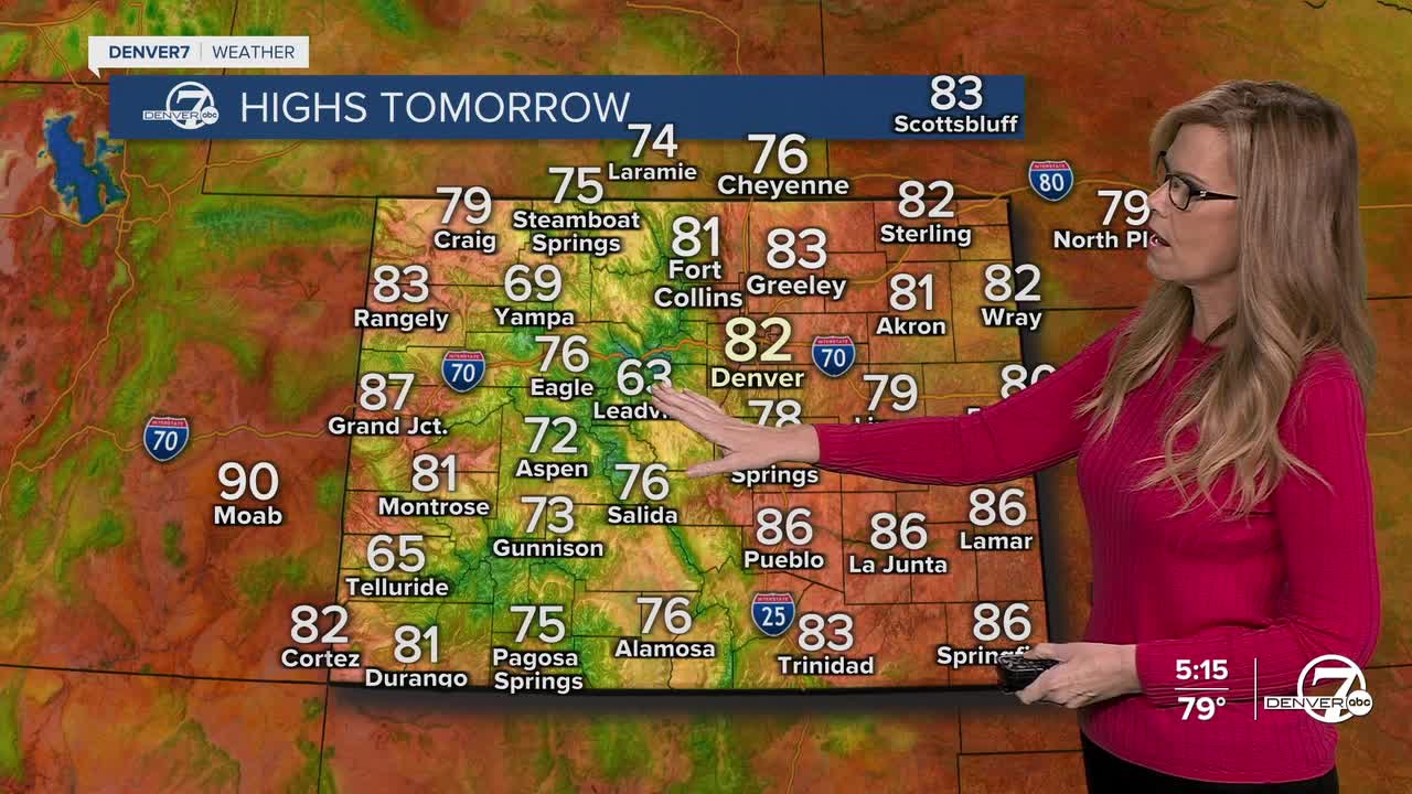
As we move into the workweek, Monday is looking warmer and drier overall thanks to a ridge of high pressure sliding over the Rockies. Still, the mountains could see a few isolated showers or weak storms during the afternoon, but they’ll be pretty limited. Most areas east of the mountains should stay dry under mostly sunny skies.

By Tuesday and through the midweek, things get a little more unsettled again. Winds aloft will shift to the southwest, and that may pull in a bit more moisture from the south. That’s enough to spark some afternoon and evening showers and storms, mainly over the high terrain, but a few could drift into the nearby foothills or plains on occasion. Still, nothing looks widespread at this point.
Looking ahead to Friday and next weekend, the pattern looks to shift again as a trough starts to dig into the western U.S. We'll likely have a better shot at rain and storms across a broader area, along with slightly cooler temperatures. So if you’ve been enjoying the warmth, you might want to soak it up early in the week before conditions start to turn a bit more fall-like.
.
DENVER WEATHER LINKS: Hourly forecast | Radars | Traffic | Weather Page | 24/7 Weather Stream
Click here to watch the Denver7 live weather stream.
