


DENVER — Skies cleared out overnight and temperatures have dipped into the 40s for the Wednesday morning commute. We'll see plenty of sunshine early on, but a few more storms are possible by the afternoon and evening.

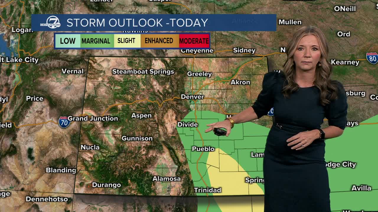
Wednesday will be the coolest day of the week and very fall-like. We'll see high temperatures in the upper 60s to low 70s and that's about 10 degrees below normal. Storms will likely develop after 3 p.m. The risk of severe weather is low near Denver, but we could see a few stronger storms from the Palmer Divide south toward Pueblo.
Some cells could bring brief heavy rain, small hail, and gusty winds before tapering off late tonight. Overnight lows dip back into the upper 40s — another cool start in store on Thursday!
Thursday brings a shift toward drier weather, but a few spotty showers or a stray thunderstorm could still pop up across parts of southern Colorado. Highs will hold in the low to mid 70s. That's about 5 to 7 degrees below normal for mid-September.
Warmer and drier weather settles in on Friday and we're in for a beautiful weekend. It'll be mostly sunny, with highs in the low to mid 80s both Saturday and Sunday.
DENVER WEATHER LINKS: Hourly forecast | Radars | Traffic | Weather Page | 24/7 Weather Stream
Click here to watch the Denver7 live weather stream.
