


DENVER — It's going to be another extremely mild fall day. We're starting off with a lot of sunshine and temperatures in the 40s and even a few 50s on the west side of town Tuesday morning. You'll find clear skies in the mountains too, with temperatures in the 20s and 30s early on.

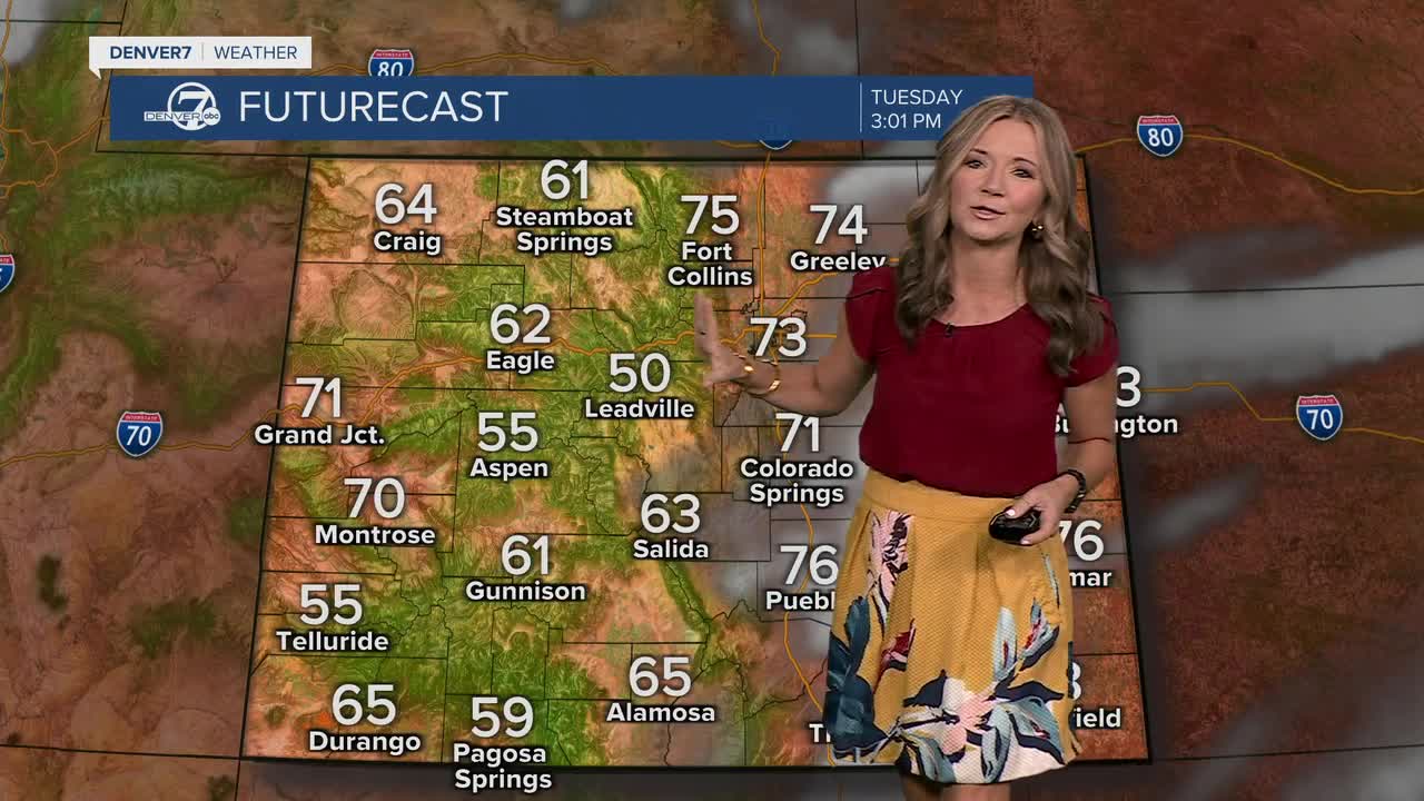
You'll find temperatures quickly climb close to 70 degrees by lunch, with highs near 75 degrees by happy hour. Tuesday's temperatures are close to record territory. Denver’s current record high today is 77 degrees set back in 2020.
Downsloping winds will help warm things up, although a few afternoon clouds could keep temperatures just shy of the record. It’ll be another dry day overall, and with low humidity and breezy conditions, fire danger will be elevated along the Wyoming–Nebraska border.
By Tuesday night, a weak cold front will slide through, knocking temperatures down just a bit for Wednesday. It will still feel pleasant for this time of year, with highs in the 60s and light winds. Skies will be mostly sunny, and no rain or snow is expected anywhere in the region.
Another weak storm is set to roll through later this week. We'll see increasing clouds on Thursday, with the chance for a little rain/snow in the northern and central mountains late Thursday into early Friday.
Temperatures will also return to our seasonal norms, with highs likely in the mid to upper 50s through the weekend under a mostly sunny sky.
Looking ahead into early next week, quiet and mild weather continues. Another weak system may brush by the area, but most places will stay dry. High pressure will rebuild over the west, keeping skies mostly sunny and temperatures trending back above average again. It’s a nice stretch of fall weather overall — warm days, cool nights and very few weather worries on the horizon.
DENVER WEATHER LINKS: Hourly forecast | Radars | Traffic | Weather Page | 24/7 Weather Stream
Click here to watch the Denver7 live weather stream.
