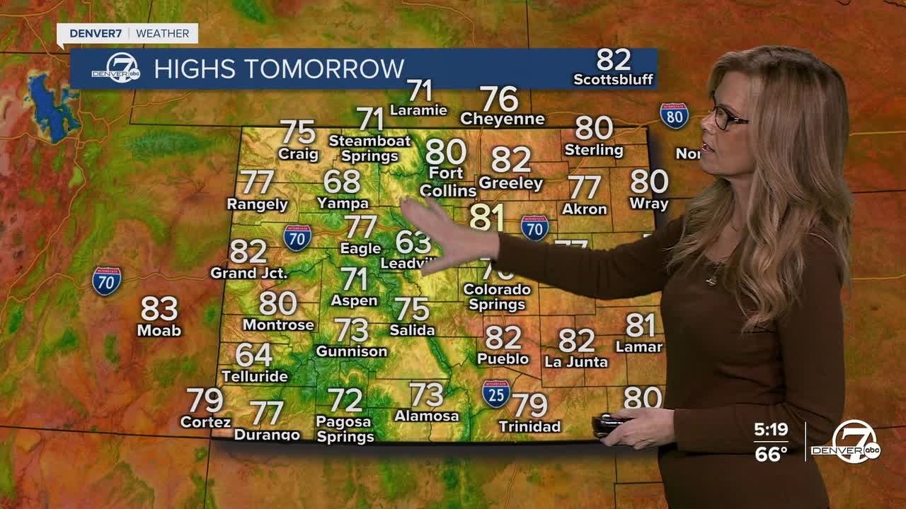


DENVER — Tonight looks quiet and comfortable around the area. Skies will be mostly clear thanks to high pressure holding strong overhead, and you can expect a cool but pleasant evening. It will be a cool overnight and early Thursday morning.
Looking ahead to Thursday and into the weekend, the weather stays on cruise control. We’ll be under the influence of a strong ridge of high pressure, which means sunny skies, light winds, and daytime highs running several degrees above normal. It’s going to feel more like early fall perfection-great for getting outside, whether it’s for a walk, a hike, or checking out the fall colors.

Friday night brings a weak backdoor cold front, but don’t expect much excitement. It might knock temperatures down just a few degrees on Saturday, especially on the plains. That means still warm and dry, just not as warm. Overall, the weekend is shaping up to be mild and pleasant, with more sunshine than anything else.

Rain chances don’t really return until late Sunday, and even then, they’ll be light and mostly in the mountains. A disturbance will lift out of the Desert Southwest and brush by Colorado, but most of the moisture will stay west of us. So, unless you're heading into the higher elevations, you’ll likely stay dry.
As we move into early next week, there’s a bit more uncertainty in the forecast. Another weak system could bring a few more scattered showers or storms to the mountains Monday or Tuesday, but plains areas look to stay dry for now. Southwest flow aloft should keep us on the warmer side of things, so expect above-normal temperatures to continue through at least midweek.
DENVER WEATHER LINKS: Hourly forecast | Radars | Traffic | Weather Page | 24/7 Weather Stream
Click here to watch the Denver7 live weather stream.
