


DENVER — A few isolated thunderstorms moved into the Denver area on Tuesday afternoon, producing scattered showers and lightning in areas. That system is moving into the northeast plains, bringing with it a chance of severe storms.

The National Weather Service issued a severe thunderstorm warning for southeast Yuma and northeast Kit Carson counties until 4:30 p.m. This system is capable of producing wind gusts of up to 60 mph and quarter-size hail.
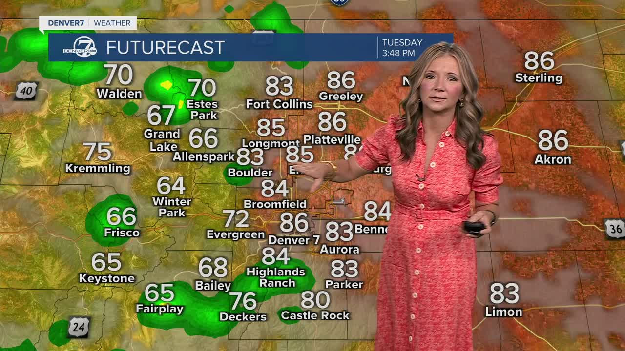
Tuesday and Wednesday will stay mostly dry and warm. We'll see very few isolated storms roll off the foothills, with highs in the mid to upper 80s around the Denver metro area. The Eastern Plains will see low 90s.
It looks like the next cold front will swing in late Thursday into Friday morning, helping to drop daytime highs into the upper 70s to low 80s Friday. We'll be tracking partly to mostly cloudy skies to end the work week along with a better chance of storms Friday afternoon and evening.
So far, it looks like we'll enjoy seasonal temperatures in the upper 70s to low 80s through the weekend.
DENVER WEATHER LINKS: Hourly forecast | Radars | Traffic | Weather Page | 24/7 Weather Stream
Click here to watch the Denver7 live weather stream.
