


DENVER — Temperatures will remain warm overnight, setting the stage for another summer-like week ahead.
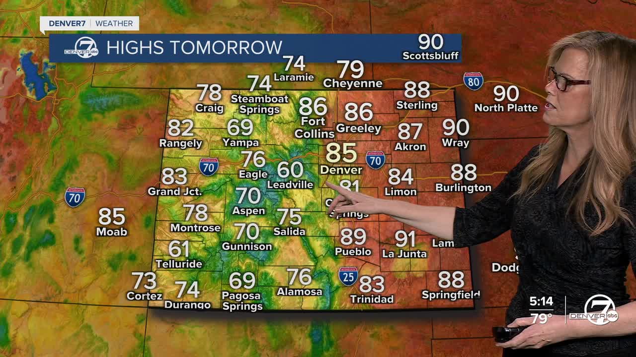
Monday brings warmer temperatures and another round of afternoon and evening showers and thunderstorms. Storms will be scattered and generally light, but some could produce gusty winds as they move across the plains. Highs are expected to climb into the mid 80s to lower 90s in lower elevations, keeping conditions feeling hot and dry outside of the storms.

Tuesday looks breezy across the plains, with south winds increasing through the afternoon and gusts possibly reaching 35 to 45 mph. A few showers and thunderstorms are still expected, though rainfall may stay spotty for many lower elevation areas.

Wednesday currently appears to be the most active day of the week. A stronger weather system moving into the region will bring more widespread showers and thunderstorms during the afternoon and evening. Storm coverage should be greater than earlier in the week, and many areas have a better chance of seeing measurable rainfall.
Thursday may bring a brief break with slightly lower storm coverage, but the quieter pattern likely will not last long. By Friday and into the weekend, afternoon and evening thunderstorms are expected to become more common again as warmer temperatures and increasing moisture combine across the region. Overall, the pattern stays warm, unsettled, and active through next weekend.
DENVER WEATHER LINKS: Hourly forecast | Radars | Traffic | Weather Page | 24/7 Weather Stream
Click here to watch the Denver7 live weather stream.
