


DENVER — Afternoon highs made it into the 60s for Wednesday afternoon and skies will remain clear into Wednesday night.

Thursday warms up nicely, with highs climbing into the 70s across much of northeast Colorado. It’ll feel dry, though, with humidity dropping quite a bit. Because of that, areas, especially south of I-70, could see elevated to even locally critical fire weather conditions in the afternoon, meaning it won’t take much for fires to start and spread.

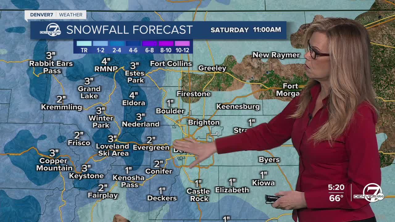
Thursday night into Friday is when the big shift happens. A cold front moves in, bringing much colder air and a chance for snow. Snow should start in the mountains late Thursday night, then spread into lower elevations and the plains during the day Friday. Totals look fairly light overall, but expect a noticeable change from warm and dry to cold and unsettled.

Friday itself will feel dramatically colder, with highs only reaching the upper 30s to low 40s. Roads in lower areas will likely stay mostly wet since the snow falls during the daytime, but mountain roads could get slick, especially over passes. The bigger story may actually be the cold rather than the snow.
By Friday night into Saturday morning, temperatures drop into the upper teens to mid 20s, leading to a hard freeze. That could be rough on early plants and any irrigation systems that are already running, so it’s a good idea to protect or drain anything sensitive. After that, the weekend gradually warms back up, with milder and drier weather returning by Sunday and into early next week.
DENVER WEATHER LINKS: Hourly forecast | Radars | Traffic | Weather Page | 24/7 Weather Stream
Click here to watch the Denver7 live weather stream.
