


DENVER — Scattered showers and a few thunderstorms are expected this evening, mainly over the mountains and into northwestern Colorado. Most of the activity should stay fairly light, and the chance for anything severe is very low. That said, a couple of storms could produce some gusty winds. Temperatures will be in the 50s overnight for the Denver metro area.
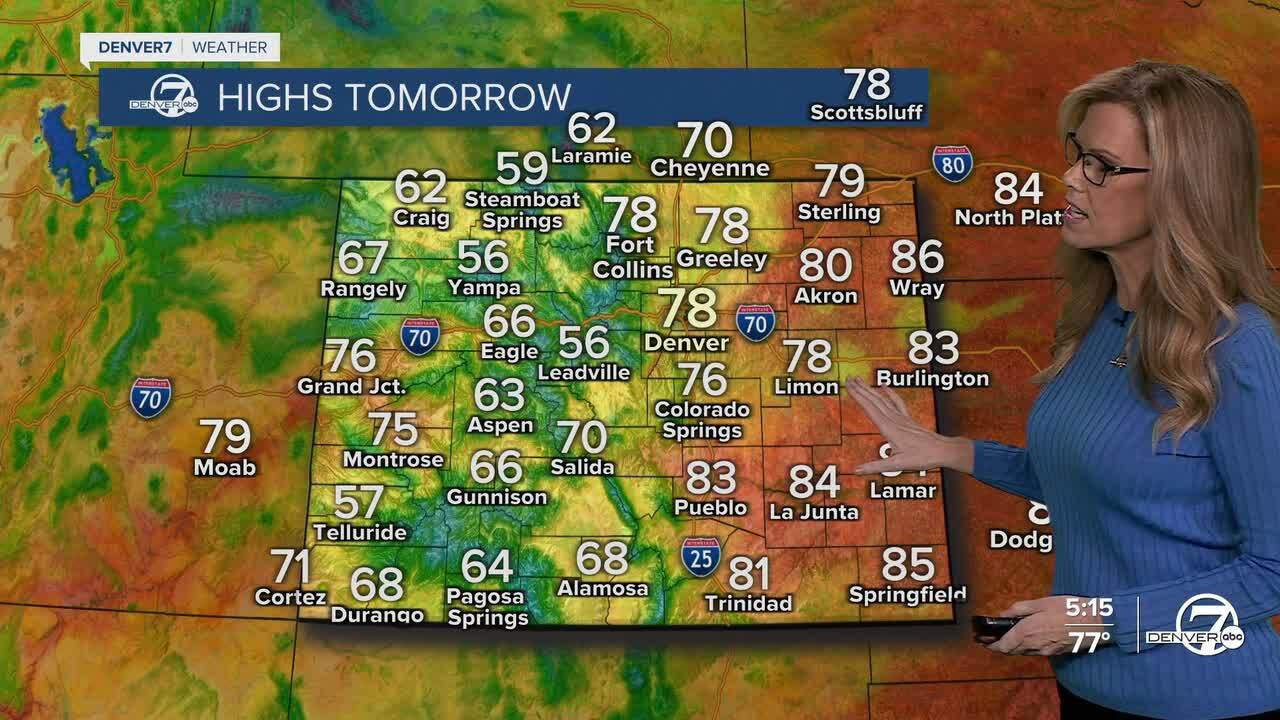
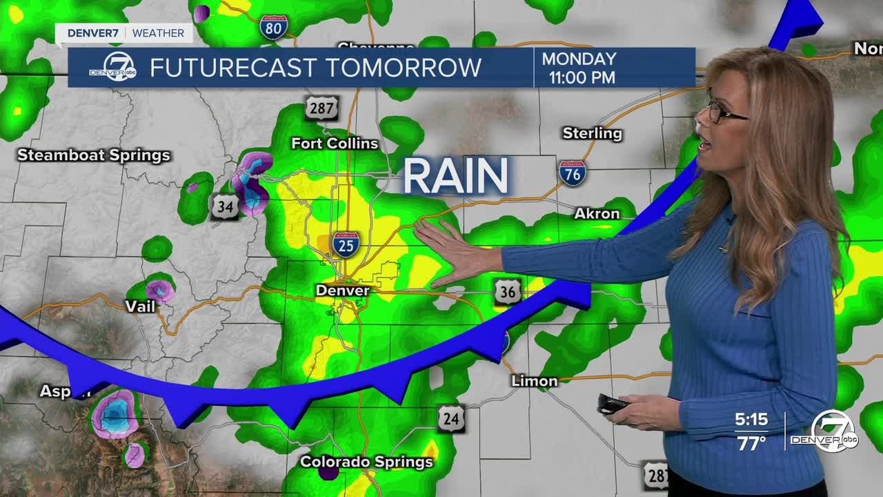
On Monday, a cold front will sweep across the area by early afternoon, bringing cooler temperatures and breezy conditions. Highs will only reach the mid to upper 70s, and winds from the north could gust up to 30 mph behind the front. Along with that, we’ll see a good chance for rain and thunderstorms, especially in the afternoon and evening. Some storms out east could be on the stronger side, with the possibility of hail and strong winds.

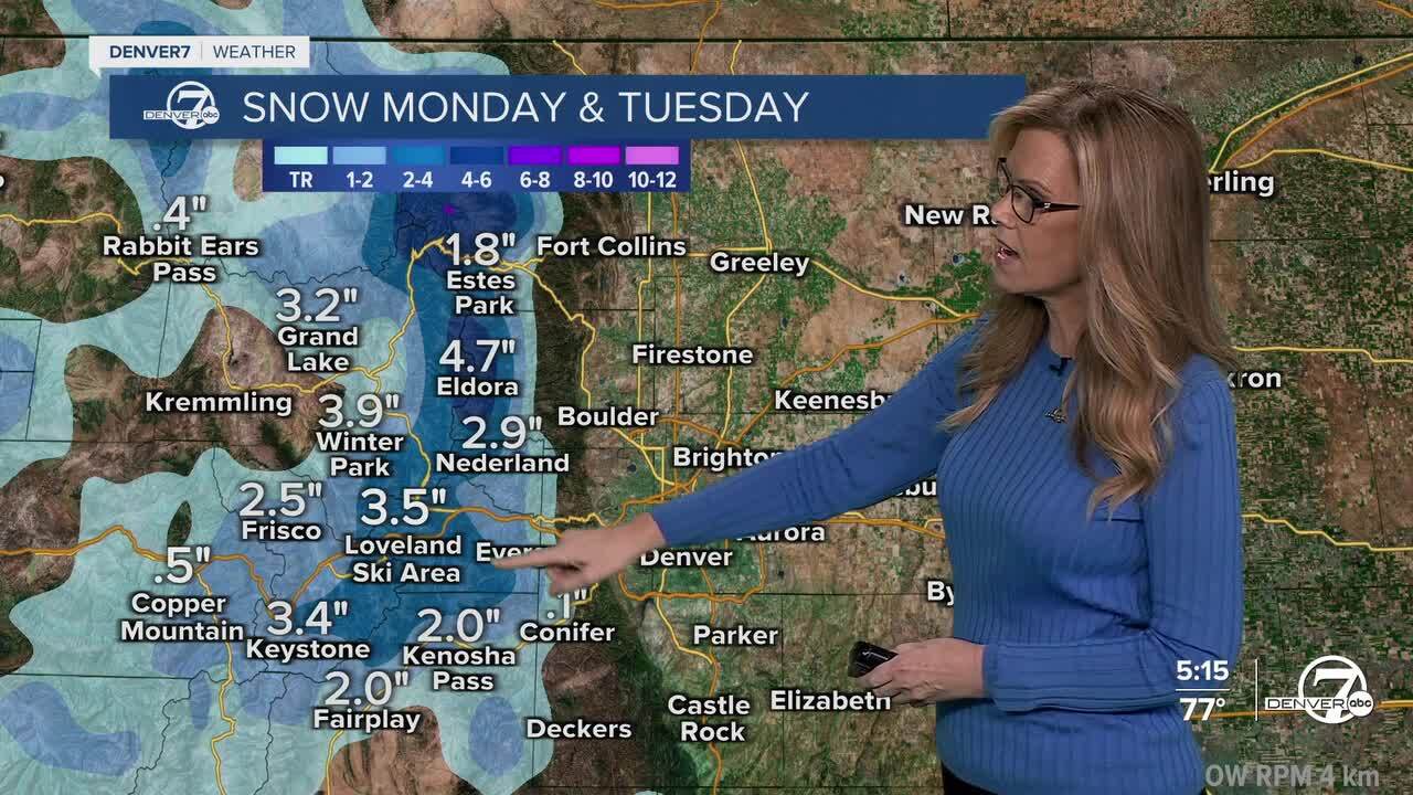
As colder air moves in Monday night, it will be cold enough for snow in the mountains. Snow levels could drop to around 9,000 feet — and maybe even as low as 8,500 feet by early Tuesday. Most of the snow will fall across the northern Front Range mountains, but if the system shifts south, some areas farther south could get in on the action too. Travel over high mountain passes could be slick Tuesday morning.
Tuesday looks to be the coolest day of the week. Highs across the plains will only reach the upper 50s to low 60s, with even cooler temperatures in the mountains and valleys. Light to moderate rain showers will continue throughout the day, but no severe weather is expected. Overall, it’ll be a chilly, damp day across much of the area.
By midweek, the weather starts to turn around. The storm system moves out and a ridge builds over the Rockies, bringing warmer and drier conditions. Temperatures will gradually return to more typical fall levels on Wednesday and Thursday. By Friday, it it will be a bit warmer with sunny and dry weather returning just in time for the weekend.
DENVER WEATHER LINKS: Hourly forecast | Radars | Traffic | Weather Page | 24/7 Weather Stream
Click here to watch the Denver7 live weather stream.
