


DENVER — Overnight, strong winds will still be a thing in the higher foothills and the Front Range. Gusts over 60 mph are possible, especially between late evening and early Sunday morning. It doesn’t look quite strong enough for official high wind warnings, but if you’re in the higher elevations, it could get blustery.
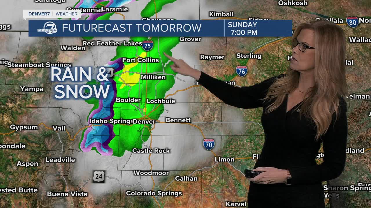
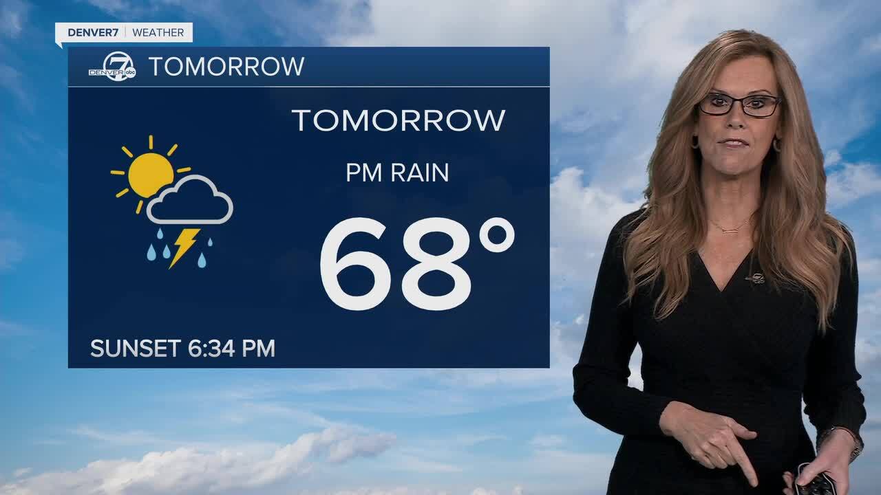
Sunday brings in another cold front during the late morning, which will drop temperatures even more through the day. Cooler, moist upslope winds will help bring in more clouds and showers by afternoon and evening. If you’re up in the northern Front Range Mountains or foothills, especially above 8,000 feet, there’s a good chance of picking up a few inches of snow. This could make for slick travel on higher mountain roads like Trail Ridge Road or around Cameron Pass.

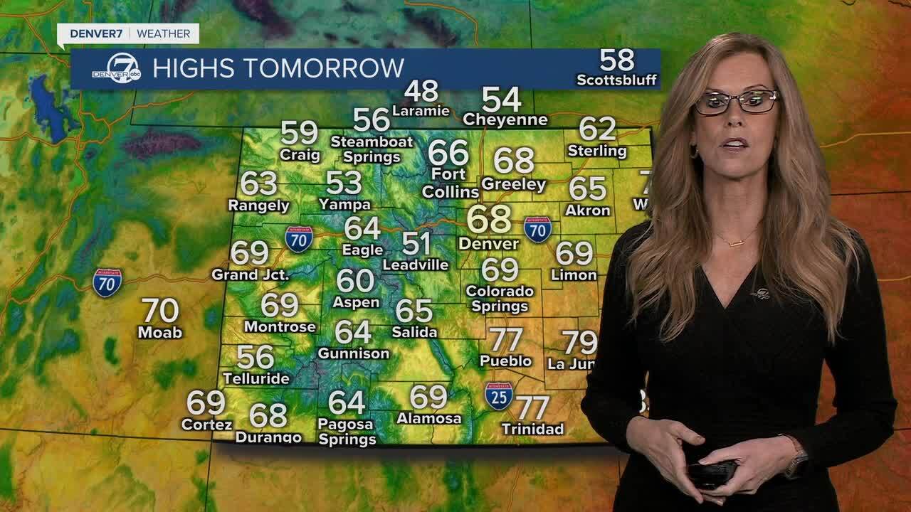
Sunday night into Monday looks downright chilly, with lots of clouds and lingering showers. Highs on Monday might not even reach the mid-50s along the I-25 Corridor and the plains. While Monday night won’t likely be frosty due to the clouds and leftover moisture, it’ll definitely feel like fall has arrived for good.
By Wednesday and Thursday, temperatures should bounce back to above normal, with drier and sunnier conditions returning.
It won’t stay cold for long, classic Colorado fall weather with a little bit of everything!
DENVER WEATHER LINKS: Hourly forecast | Radars | Traffic | Weather Page | 24/7 Weather Stream
Click here to watch the Denver7 live weather stream.
