


DENVER — A few scattered showers will be moving across the Front Range this evening. We aren't expecting severe storms, but it may be soggy.
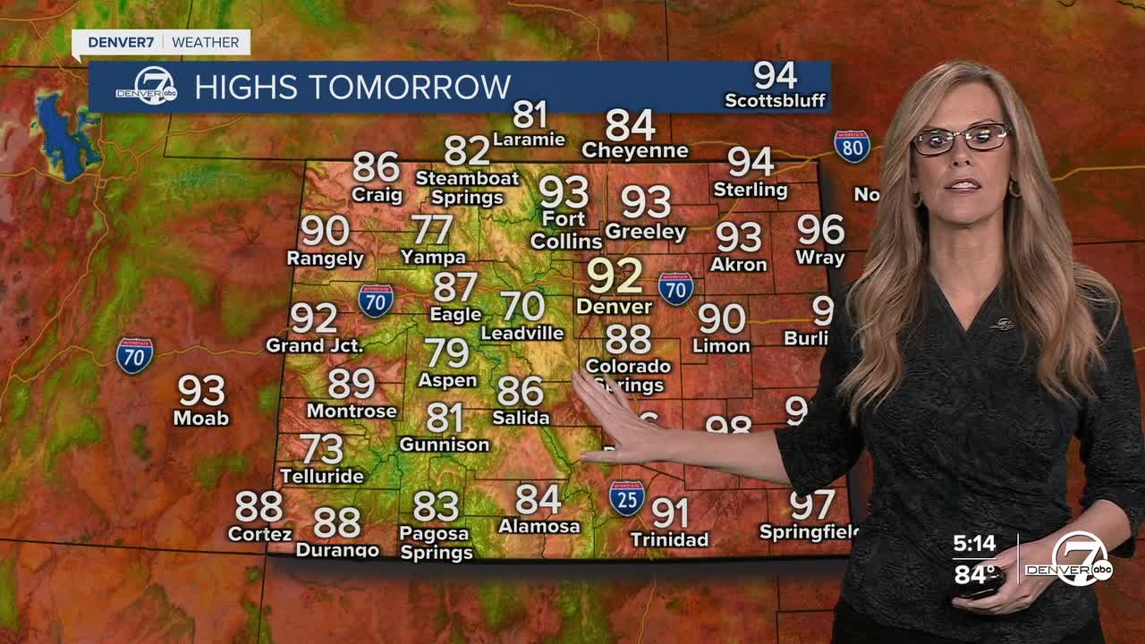
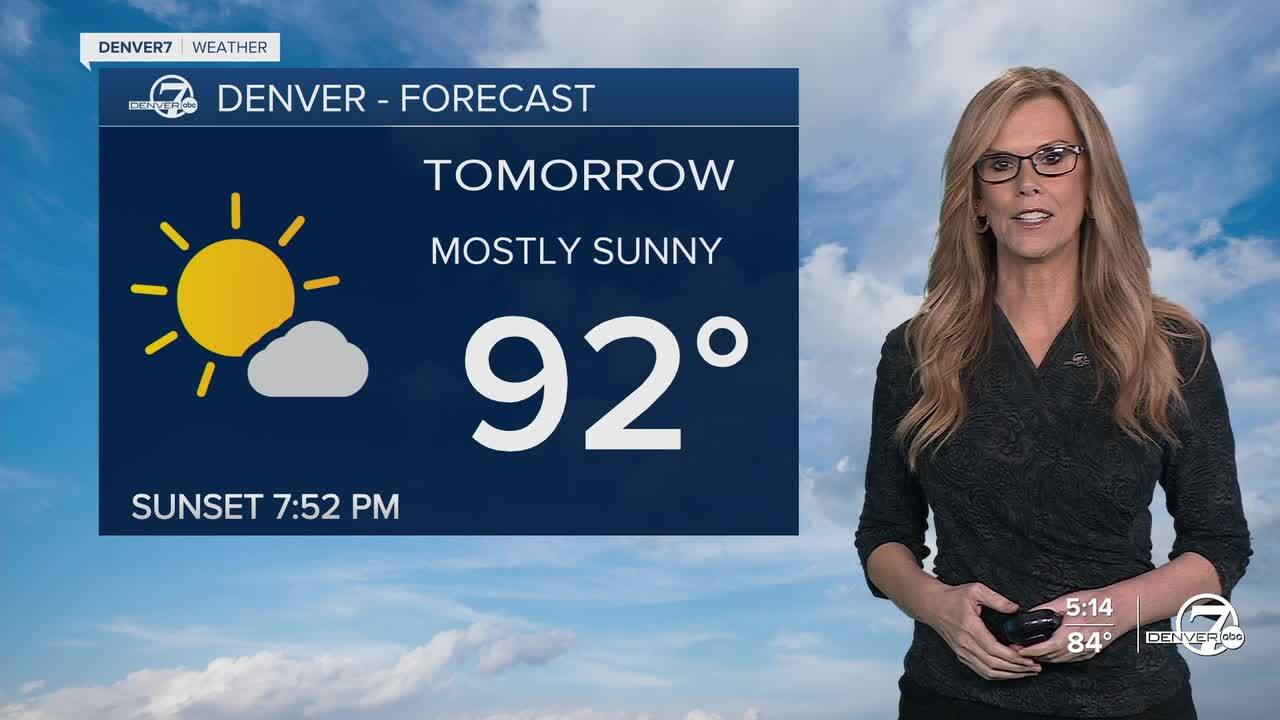
On Sunday we start a warmer, drier trend with more sunshine. Temperatures will run a bit hotter than normal, with chances for isolated showers and thunderstorms.
kmgh
That trend carries us into next week, with decreasing chances for rain and highs heating up into the mid to upper-90s by Wednesday or Thursday.
DENVER WEATHER LINKS: Hourly forecast | Radars | Traffic | Weather Page | 24/7 Weather Stream
Click here to watch the Denver7 live weather stream.
