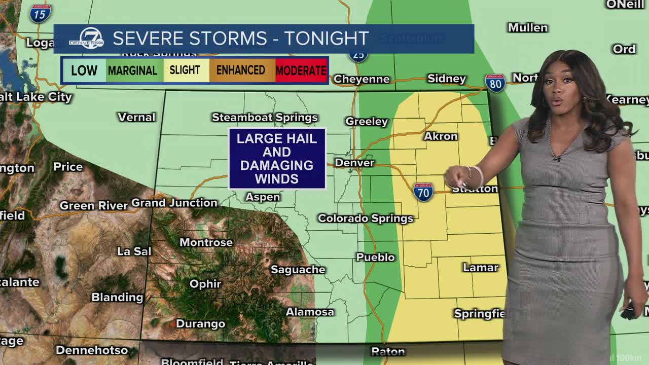


It was a beautiful start to the day, but warmer temperatures today are helping to fuel severe weather east of Denver. The storms will continue through early evening and could produce large hail, damaging winds and isolated tornadoes.
A number of severe weather alerts have been issued for the eastern plains including a Tornado Warning for a cell located about 29 miles northeast of Limon. These storms will continue to push east through early evening.
The risk of severe weather on Friday is lower, but there will still be a few late-day storms to end the week!
Temperatures will rebound quite a bit this weekend. We'll see highs in the 70s on Saturday and closer to 80 degrees on Sunday. This warm weather continues into early next week and will lead to a dry and warm BOLDERBoulder on Memorial Day.
We'll see temperatures in the 50s early Monday morning, with upper 70s by the time the elite runners start crossing the finish line at Folsom Field. A few storms are possible later in the day, but likely holding off until after the Memorial Day Tribute.
DENVER WEATHER LINKS: Hourly forecast | Radars | Traffic | Weather Page | 24/7 Weather Stream
Click here to watch the Denver7 live weather stream.
