


DENVER-Starting tonight, things are staying pretty quiet across the region, but winds are starting to pick up in the mountains as the next weather system moves in. If you're east of the Rockies, you'll notice a mild evening thanks to some downsloping winds and a bit of cloud cover. In higher elevations, gusts could reach up to 50 mph by early Saturday morning, so if you're in those areas, hang on to your hats.

Saturday will bring a big change as a cold front pushes through during the late morning and early afternoon. Expect gusty winds all across the plains and foothills, 30 to 45 mph in some spots. Temperatures will cool off quite a bit, staying in the 50s for most places east of the mountains. There’s a small chance for light snow or rain showers in the northern mountains and around the Cheyenne Ridge, but it won’t amount to much. Despite the cool-down, fire danger will remain a concern, especially in areas west of I-25 where dry conditions and wind could combine for near-critical fire weather.

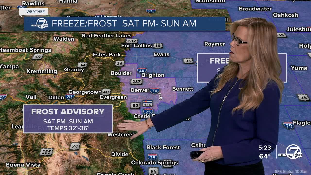
Saturday night will be our first real taste of winter for many, with a widespread freeze expected. Temperatures will dip below freezing in most spots, and some of the coldest areas out on the plains could drop into the upper 20s. A Freeze Watch has been issued for areas with the highest confidence in those colder readings. If you’ve still got sensitive plants outside, it’s time to bring them in or cover them up.
Sunday will feel more like fall again, with temperatures climbing back into the mid to upper 70s for much of the area. Winds won’t be as strong as Saturday, but it’ll still be quite dry. Fire danger remains elevated, especially for the foothills, Palmer Divide, and parts of the urban corridor, where gusty winds could mix down in the afternoon. In the mountains, expect the windy conditions to continue with gusts still reaching 40 to 50 mph.
Looking ahead to Monday, another cold front sweeps through with more strong winds and a dip in temperatures. There’s a chance for a few snow showers again in the northern mountains, but moisture will still be limited. Fire danger will stay high, especially east of the Rockies. Another freeze is likely Monday night, but by Tuesday, the pattern starts to settle down. Winds will relax, and temperatures return to more seasonal levels. There may even be a chance for some midweek moisture as another system approaches by Wednesday.
.
DENVER WEATHER LINKS: Hourly forecast | Radars | Traffic | Weather Page | 24/7 Weather Stream
Click here to watch the Denver7 live weather stream.
