

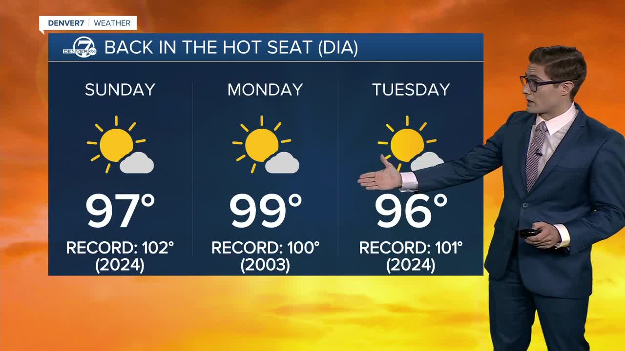


DENVER — The heat is on again today across Colorado as a powerful ridge of high pressure slowly drifts north. The center of the heat dome is currently over northwestern Colorado and will gradually shift through Wyoming before reaching the Dakotas over the next few days.
That means another dry, scorching day across the state. Highs will climb into the upper 90s across the Denver metro, while parts of the Western Slope soar into the triple digits. Expect abundant sunshine, along with a bit of haze across the Front Range. While some wildfire smoke remains in the region, much of the haze today is a mix of pollutants trapped beneath the ridge.
An Ozone Action Day Alert remains in effect for the metro area until 4 p.m.
Denver's record high for today is 102 degrees, and we're expected to stay just shy of that mark. The hottest temperatures will once again be found closer to the center of the heat dome across the lower elevations of western Colorado.
An Extreme Heat Warning remains in effect for northwestern Colorado through Monday night, while a Heat Advisory continues for parts of southwestern Colorado through tonight. If you're spending time outdoors, stay hydrated, take breaks in the shade, and apply sunscreen frequently.
In the high country, afternoon highs will reach the 70s under partly cloudy skies. A few isolated sprinkles are possible, but the ridge's strength should keep most locations dry.
Temperatures will stay warm well into the evening, with southeast winds increasing this afternoon and tonight. Gusts of 25 to 30 mph will be possible, especially on the east side of the metro.
The sizzling heat continues Monday, when Denver will once again flirt with record territory. The record high is 100 degrees, and forecast highs are expected to come close. Heat Advisories may eventually be needed for parts of the metro if the forecast holds.
The ridge will weaken only gradually through the week, keeping temperatures above average and fire danger elevated, especially in the mountains where breezy afternoons and dry vegetation due to ongoing drought will remain a concern. Record highs remain possible in parts of the central mountains.
By next weekend, the pattern may finally begin to shift. Monsoon moisture should gradually return, bringing a better chance of afternoon thunderstorms, especially along the U.S. 40 corridor. Storm chances in Denver appear lower for now, with highs still expected to remain in the mid-90s.
DENVER WEATHER LINKS: Hourly forecast | Radars | Traffic | Weather Page | 24/7 Weather Stream
Click here to watch the Denver7 live weather stream.
