


And so it begins, rain affecting the front range and eastern plains tonight.
Rain will become more widespread tonight into Monday, while snow ramps up across the mountains and foothills. Temperatures will take a nose dive by Monday, with chilly, damp conditions sticking around through much of the day. Areas along and west of the foothills will likely see periods of steady precipitation.

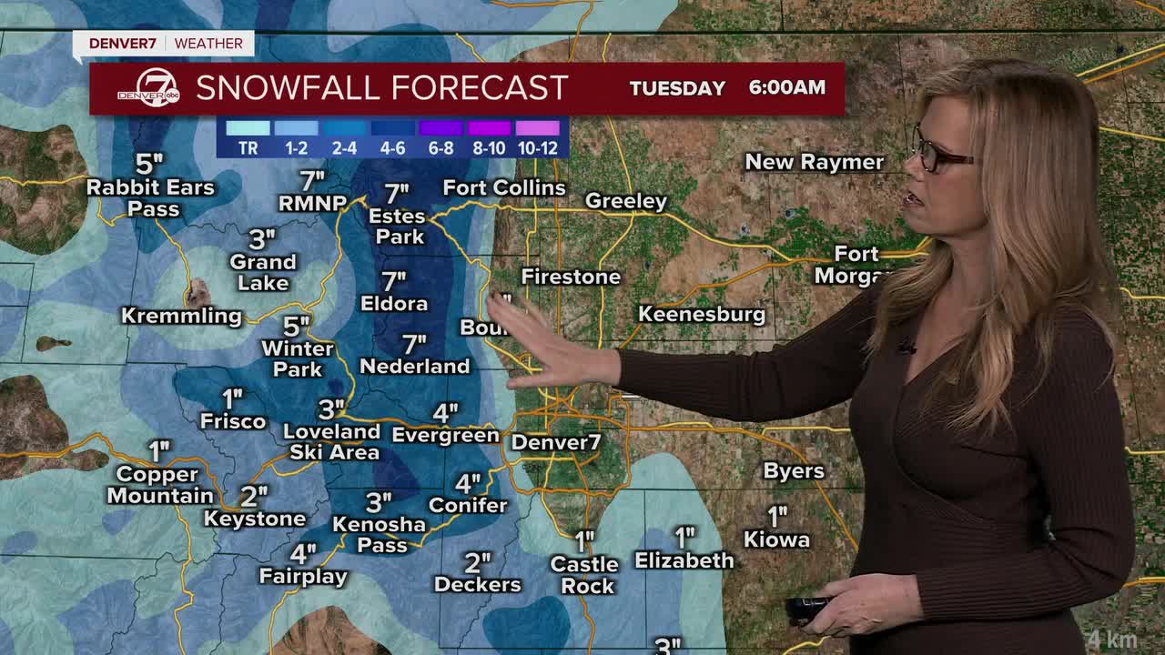
The mountains are expected to pick up several inches of accumulating snow, especially in the higher elevations north of I-70. The foothills also have a strong chance of seeing accumulation by Monday, especially above about 6,500 to 8,000 feet. Around the I-25 Corridor and metro areas, it will mostly stay rain, though a few wet snowflakes could mix in late Monday afternoon or evening. From Estes Park to Leadville, we have a Winter Weather Advisory in effect for Monday as we expect 4-12 inches of snow.

Monday night could bring one last spring freeze for parts of the plains as temperatures fall close to or just below freezing. Whether it gets cold enough in the cities will depend on how quickly skies clear and winds calm down, but colder rural areas have a better chance of dipping below freezing overnight.

The warmer and drier weather pattern is still on the way, but it’s arriving a little later than expected.
Scattered showers and a few storms may linger through the middle of the week before conditions gradually improve. By Friday and into next weekend, temperatures should rebound to above normal with much drier weather returning.
DENVER WEATHER LINKS: Hourly forecast | Radars | Traffic | Weather Page | 24/7 Weather Stream
Click here to watch the Denver7 live weather stream.
