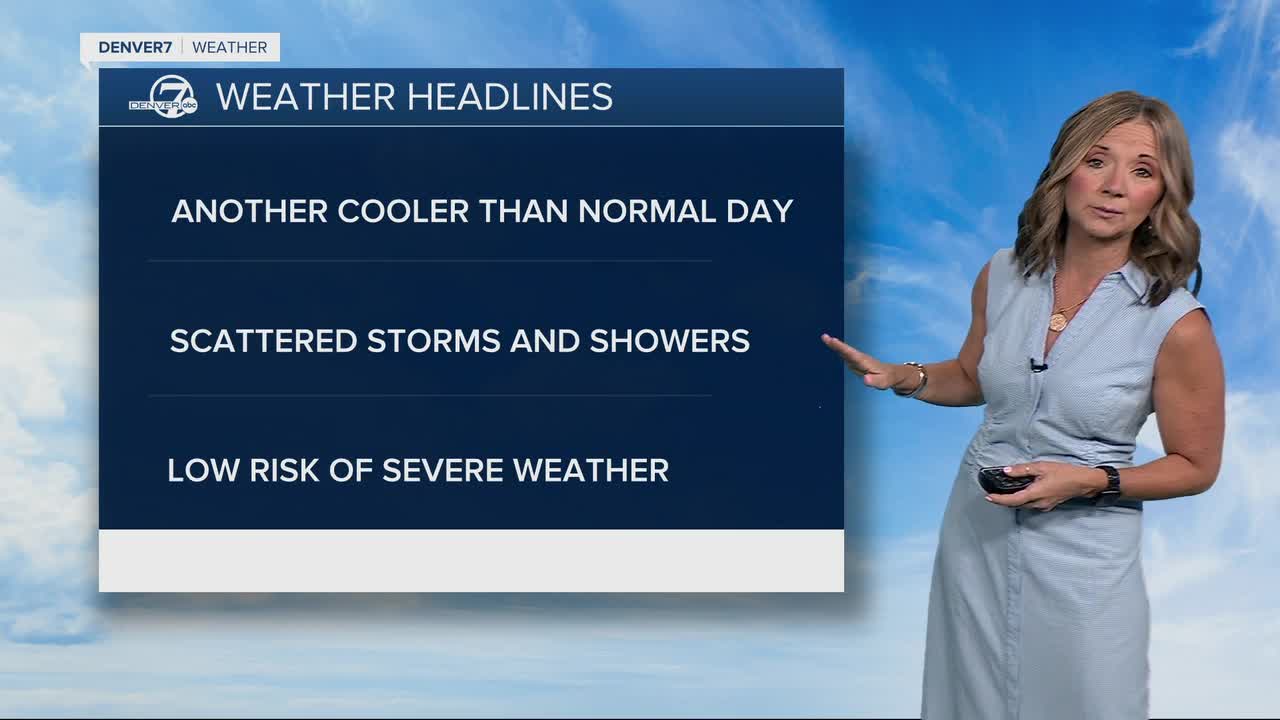


More rain fell overnight, but we're waking up to something we haven't seen in the last two days... a little sunshine!! Enjoy it while you can because we'll see increasing clouds and more scattered showers will develop after lunch.
Storms will race across the Denver metro area and plains by early afternoon and most move east on to the plains by 7 p.m. So far, it doesn't look like any cells will turn severe across Colorado today but we could see some stronger storms tomorrow.
Daytime highs will sit in the upper 50s to low 60s along the urban corridor Wednesday with slightly warmer weather on tap for the rest of the work week.
While we get a brief break from the wet weather Wednesday night into Thursday morning, you'll finally see some dry roads for the Thursday morning commute, with a chance of storms later in the day. A few of these storms could produce larger hail and damaging winds east of Denver and closer to spots like Limon and Burlington. Highs will head into more seasonal territory, in the upper 60s to low 70s.
Look for mid-60s Friday with partly cloudy skies and a few isolated afternoon storms. So far, it looks like a much warmer and drier weather pattern takes over as we head into Memorial Day weekend.
We'll be in the 70s and low 80s Saturday and Sunday with mostly sunny skies - perfect weather to get outside! Right now, it looks like a few isolated storms are possible Monday afternoon but they shouldn't impact your outdoor plans too much. Stay tuned to the Memorial Day forecast as it gets a bit closer.
DENVER WEATHER LINKS: Hourly forecast | Radars | Traffic | Weather Page | 24/7 Weather Stream
Click here to watch the Denver7 live weather stream.
Denver7 live 24/7 weather stream
DENVER WEATHER LINKS: Hourly forecast | Radars | Traffic | Weather Page | 24/7 Weather Stream
Click here to watch the Denver7 live weather stream.
