


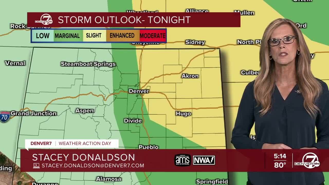
DENVER- Tonight is looking active across the I-25 corridor and the eastern plains, with strong to severe thunderstorms expected to roll through. These storms could bring large hail—some bigger than an inch—and damaging wind gusts that could top out near 70 mph, especially around places like Fort Morgan, Akron, and Sterling. While the storms should start to calm down overnight, there’s still a slight chance of a few showers sticking around, mainly in the eastern plains. Most of the heavy rain potential has been removed from the forecast for tonight. A Severe Thunderstorm Watch is in effect for the Front Range and NE Colorado until 9pm Sunday night.
Monday will feel like a cool-down compared to today. It’ll be cloudy in the morning with some low clouds hanging around, especially along the I-25 corridor. These clouds will keep the temperatures down, likely topping out in the upper 70s. Most of the area, especially north and east of Denver, will stay dry because the atmosphere won’t be very supportive of storms. However, if you're heading toward the southern foothills or South Park, be prepared for some afternoon storms, and some could bring heavy rain.

As we get into Tuesday and Wednesday, things start to heat back up. A ridge of high pressure will settle over the state, and that means sunshine and rising temperatures. By Wednesday, it’ll feel like summer in full swing with highs in the mid 90s across the plains. There's also a small chance for a few strong storms to sneak into the far northeastern corner of the state on Tuesday, thanks to high humidity and unstable air.
Looking ahead to the Fourth of July on Thursday, expect more typical summer weather with near-normal temperatures and scattered afternoon thunderstorms. The setup looks like it’ll bring tropical moisture into Colorado, which means storms could be a bit more widespread later in the day. Still, it doesn’t look like a complete washout, so most Independence Day plans should be okay with just a watchful eye on the sky.
Friday could be even stormier depending on how a weather system over Arizona shifts. Right now, models are split—some showing Thursday as the wetter day, others leaning toward Friday. So if you're planning a long holiday weekend outdoors, it’s a good idea to keep checking the forecast for updates. Either way, expect a mix of sun, warmth, and some classic afternoon thunderstorms to finish out the week.
DENVER WEATHER LINKS: Hourly forecast | Radars | Traffic | Weather Page | 24/7 Weather Stream
Click here to watch the Denver7 live weather stream.
