


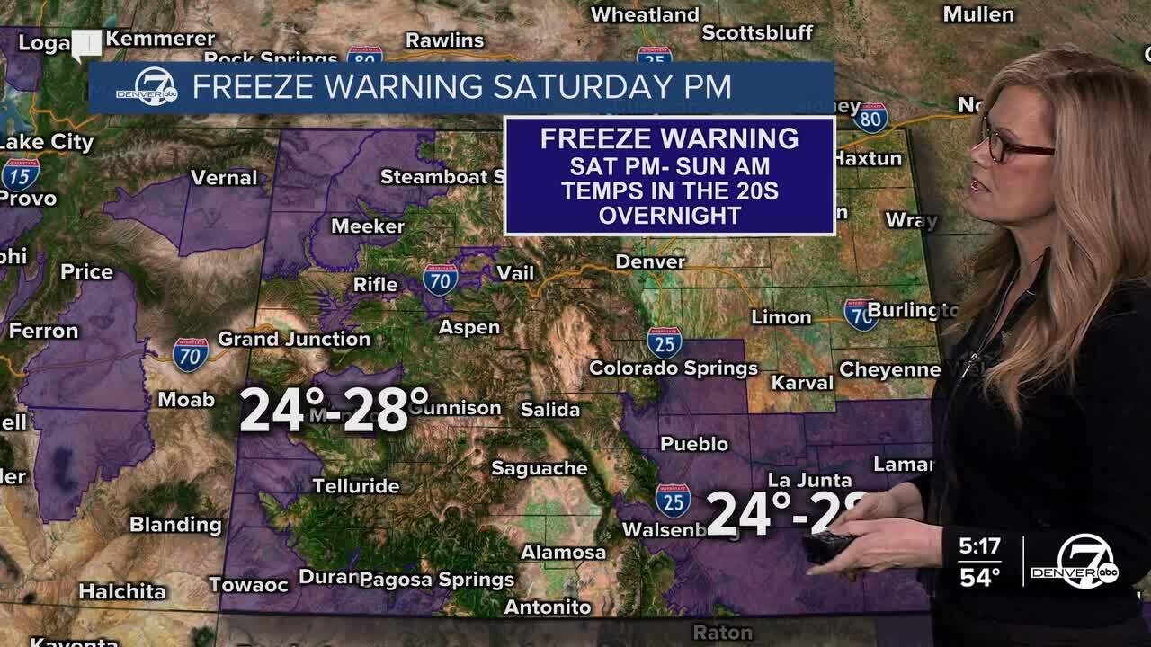
DENVER — Winds will calm down overnight, and while the air stays dry, temperatures won’t drop as sharply as last night for most areas along the plains and I-25 corridor. A few colder pockets, especially in river valleys north and east of Denver, could still dip into the 20s, but most spots should stay above freezing.

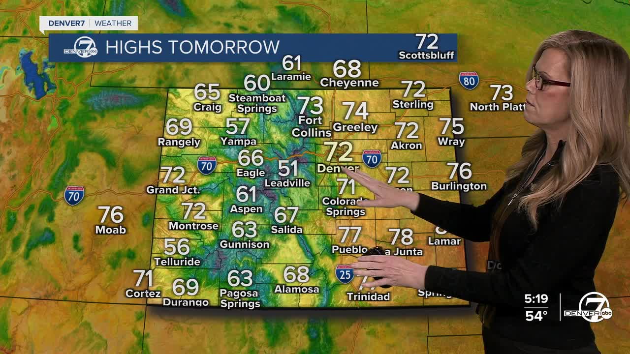
Sunday kicks off a steady warm-up with lots of sunshine. Highs will climb into the 70s across the plains, and it’ll feel comfortable overall with lighter winds. The mountains will also warm up, reaching the 50s in the valleys. Dry conditions stick around, but fire danger should stay fairly low since winds won’t be too strong.
By Monday and Tuesday, it’ll feel more like early summer than spring. Highs surge into the 80s on the plains, with 60s in the mountain valleys. Skies stay mostly clear, and the dry pattern continues. Even though it’s warm and dry, winds should remain light enough to keep fire weather concerns from becoming too serious, at least for now.
Wednesday is the day to watch. It’ll be hot, windy, and very dry, which is a rough combination for fire danger. Gusty southwest winds and humidity dropping below 10 percent will likely create critical fire weather conditions across much of the area. Temperatures will again reach the 80s on the plains, and even the mountains will be unusually warm. A few snow showers could develop over the higher peaks, but most places stay dry.
Starting Thursday and heading into next weekend, the pattern turns more unsettled. A series of storm systems moving in from the Pacific should bring increasing chances for rain, and possibly some snow at times, mainly overnight or in the mountains. It’s still a bit uncertain how much precipitation will fall, but there’s a decent chance many areas will see some moisture before the end of the week, along with cooler and more changeable weather.
- See the full forecast in the video player below.
DENVER WEATHER LINKS: Hourly forecast | Radars | Traffic | Weather Page | 24/7 Weather Stream
Click here to watch the Denver7 live weather stream.
