


Tonight will stay warm and breezy, with a few isolated showers and thunderstorms developing through the evening. Most of these storms won’t bring much rain, but they could produce strong wind gusts, especially across the plains and foothills. A few gusts could top 40 to 45 mph, but skies will clear overnight.

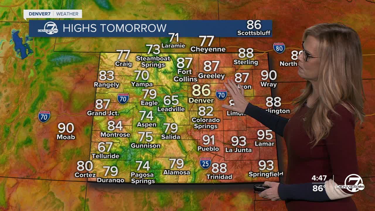
Thursday will feel a lot like summer, with temperatures climbing close to record highs once again. Most areas will stay dry, although a few spotty afternoon showers or storms could pop up, mainly south of Denver and near the higher terrain. Winds will pick up during the afternoon, and dry conditions combined with gusty weather will create elevated fire danger, especially across the plains and foothills.

Friday stays warm and mostly dry, continuing the early summer feel. Afternoon temperatures will remain well above normal, though a couple isolated showers or thunderstorms could develop near the foothills and Palmer Divide later in the day. Fire weather concerns will continue because of the dry air, warm temperatures, and breezy winds.

By the weekend, the weather pattern starts to shift. Saturday brings a better chance for afternoon and evening thunderstorms, and a few of those storms could become stronger if enough moisture moves back into the area. While there will still be some warm weather around, clouds and storm chances will gradually increase through the day.
Sunday into Monday looks noticeably cooler and wetter. Forecast trends continue to point toward more widespread showers and thunderstorms, with steadier rain possible at times by late Sunday and Monday. Temperatures could drop all the way back into the 50s by Monday, giving the area a much cooler and more unsettled start to next week.
DENVER WEATHER LINKS: Hourly forecast | Radars | Traffic | Weather Page | 24/7 Weather Stream
Click here to watch the Denver7 live weather stream.
