


DENVER — Tonight will be the coldest night of the week. The clear and dry conditions will allow temperatures to drop quickly, with lows in the low teens across the plains and the urban corridor. Be careful of the slippery conditions on sidewalks and side streets- everything will freeze over tonight.

Some spots, especially along the Palmer Divide and other colder areas, could fall into the single digits.
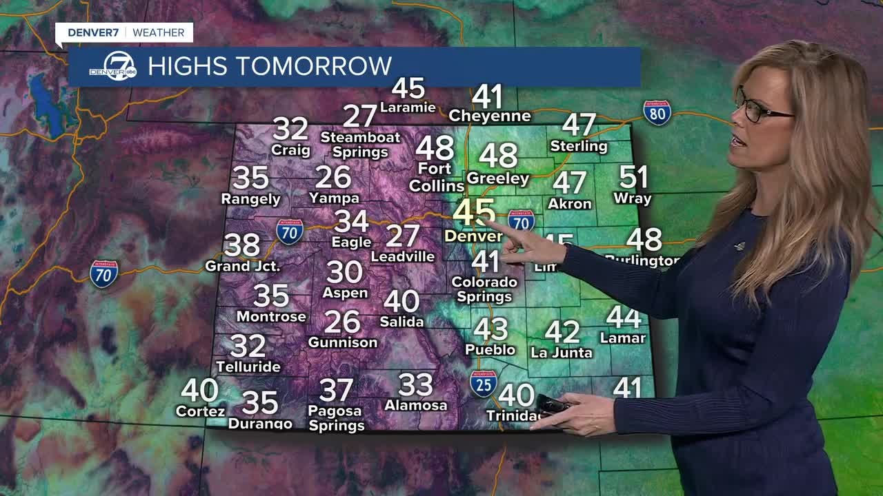
Saturday will bring plenty of sunshine and dry weather. Temperatures will begin to warm compared to tonight, though the morning will still be cold. Winds may be a bit breezy at times, but no major wind problems are expected. Overall, it will be a quiet and pleasant winter day. The weather will be excellent for the Stock Show all weekend.

Sunday will continue the warming trend as high pressure remains in control. Dry conditions will persist, and temperatures will rise to near or above normal for this time of year. Winds will remain light to occasionally breezy, making for another calm day across the region.
Monday and Tuesday will be the warmest days of the period. High temperatures are expected to reach the upper 50s to near 60 degrees across the I-25 corridor and plains. The weather will stay dry through at least midday Tuesday, though breezy conditions could develop and lead to elevated fire weather concerns on the northeast plains, especially Tuesday.

The next chance for precipitation arrives late Tuesday and continues into Wednesday. Any precipitation looks light at this time, but clouds may increase and temperatures could cool slightly afterward. Another weak system later in the week could bring additional light precipitation and a return to cooler weather, especially across the northeast plains.
DENVER WEATHER LINKS: Hourly forecast | Radars | Traffic | Weather Page | 24/7 Weather Stream
Click here to watch the Denver7 live weather stream.
