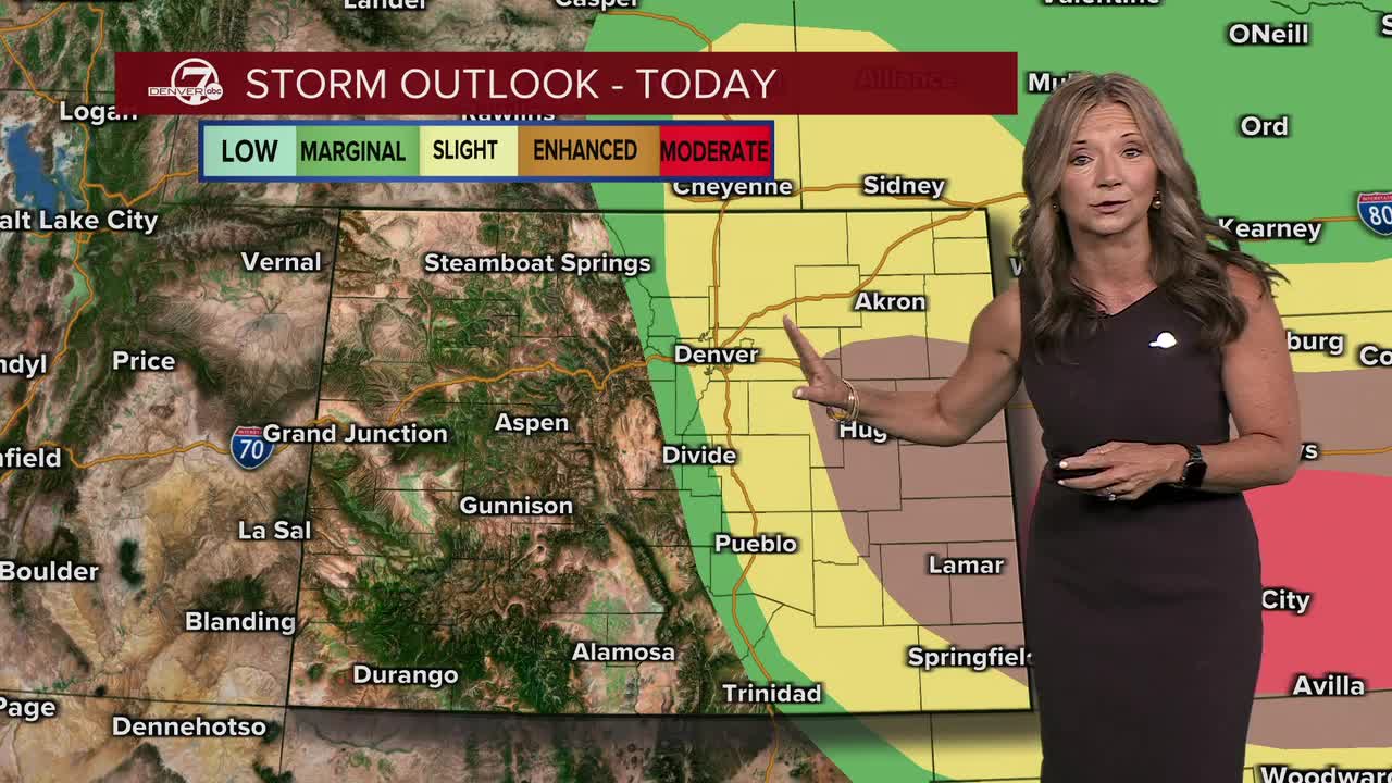


Strong storms hit northeastern Colorado overnight and those cells are pushing south and east across the plains Tuesday morning. The biggest threat with these cells is large hail, pockets of heavy rain and lightning.

These storms will fizzle out, but we'll see another round of storms Tuesday afternoon and early evening. We could see hail up to 2 inches in diameter, wind gusts near 80mph and more lightning. Some of the strongest storms will likely be across the far eastern plains, but the risk of severe weather does include the Denver metro area.
Tuesday will be the coolest day of the week, with highs in the low to mid 70s.
This cooler weather does not last long as the sizzling June heat builds through the rest of the work week. We'll be back in the 80s on Wednesday and then mid to upper 90s Thursday. It gets even hotter by Friday, with potentially our first triple digit day of the year! Cooler days return next week.
DENVER WEATHER LINKS: Hourly forecast | Radars | Traffic | Weather Page | 24/7 Weather Stream
Click here to watch the Denver7 live weather stream.
