


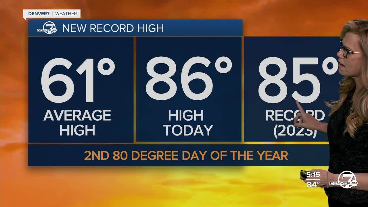
DENVER- Sunday starts off warm again, but we’ll start to notice some changes as the day goes on. By the afternoon, there’s a good chance of scattered showers popping up, mostly in the mountains at first.
Some of that rain will drift down into the Denver area by late afternoon, but it’s not looking like a total rain-out. Temps will be a bit cooler than today, especially with cooler air sneaking in early. Expect highs to drop into the upper 60s to around 70 degrees.

Sunday night is when things really start to shift. A weather system will move in, bringing a better shot at some rain for most of the area. If you’re in the foothills or along the Palmer Divide, you’ll probably see more steady showers, and maybe even hear a rumble of thunder. Most of it will stay as rain, but if it gets heavy and cold enough for a short stretch, there’s a slight chance for a rain/snow mix in a few spots. Higher up in the mountains, 2 to 5 inches of snow are expected, so travel up there could get slick by Monday morning.
Monday will feel a lot cooler behind that front. We’ll be down in the upper 50s across the plains, with colder temps in the foothills and mountains. It’ll still be a bit breezy, but it’s a big change from the summer-like weather we’ve had. Definitely a day where you’ll want a light jacket handy.
By Tuesday, we start to dry out and warm back up again. Sunshine will return for most of the day, though there might be a few showers in the mountains during the afternoon. Down in the lower elevations, it should stay mostly dry. Looking ahead to later next week, it’s starting to look more active again, with chances for more mountain snow and some possible rain down lower—something to keep an eye on.
DENVER WEATHER LINKS: Hourly forecast | Radars | Traffic | Weather Page | 24/7 Weather Stream
Click here to watch the Denver7 live weather stream.
