


DENVER — Tonight temperatures will be seasonably cold, generally around the lower 20s on the plains, with some areas staying a bit warmer due to light winds. Colder readings are expected where snow is on the ground, especially east of the Palmer Divide.

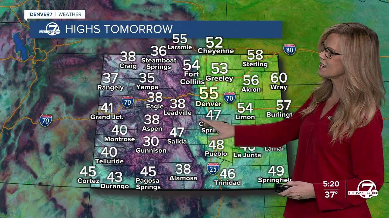
Sunday through Tuesday will stay dry with a gradual warming trend. Highs on the plains will climb into the 50s on Sunday and reach the mid-50s to near 60 by Monday and Tuesday, while mountain valleys warm into the upper 30s and 40s. Snow-covered areas will remain a little cooler, and breezy conditions are possible near the Wyoming border Tuesday afternoon.
Late Tuesday night into early Wednesday, a weak cold front will move through. There is a small chance, less than 20 percent, of light rain or snow in far northeast Colorado early Wednesday, but most areas will stay dry. Temperatures will cool slightly with highs mainly in the 50s on the plains and colder conditions in the mountains.
Thursday will turn warmer again as dry air returns. Highs will rebound into the mid to upper 50s across the plains and the 40s in mountain valleys. Gusty northwest winds are expected, which could lead to elevated fire weather conditions across the plains during the afternoon.
Looking toward Friday and next weekend, confidence is lower. A cool down is possible, especially late in the week, with temperatures potentially dropping into the 40s on the plains. There is a small chance of light snow, mainly in the mountains, and only a low chance of snow elsewhere as the week comes to an end.
DENVER WEATHER LINKS: Hourly forecast | Radars | Traffic | Weather Page | 24/7 Weather Stream
Click here to watch the Denver7 live weather stream.
