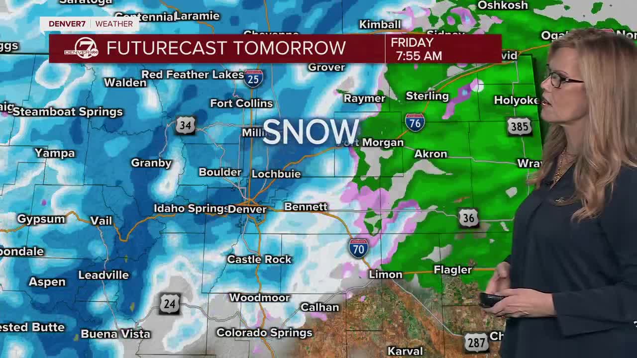


DENVER — Late tonight, a powerful winter storm will swing into Colorado ushering in heavy mountain snow and a bit of a rain/snow mix to the Interstate 25 corridor and plains. So far, it looks like it'll be a slushy and snowy Friday morning (and evening) drive across the city with possibly 1 to 3 inches of accumulation in Denver. We'll see some slightly heavier accumulation along the Palmer Divide and west up into the foothills.
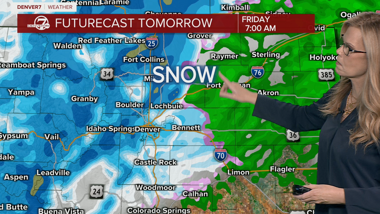
A Winter Storm Warning is in effect for the Front Range mountains for 6 to 14 inches of new snow starting late Thursday night into Friday night. Gusty winds will make travel extremely treacherous with blowing and drifting snow along the higher mountain passes.
A Winter Weather Advisory is in effect Thursday night through Friday night for the Front Range foothills for 4 to 10 inches of new snow as well as Vail, Aspen and Snowmass. The Park and Elkheads could see 4 to 10 inches along with Rabbit Ears Pass and the Flattops.
Warm, dry, sunny weather returns for the weekend and into early next week. We'll see more sunshine on Saturday with highs in the low 50s. It'll be close to 70 again by Sunday!
DENVER WEATHER LINKS: Hourly forecast | Radars | Traffic | Weather Page | 24/7 Weather Stream
Click here to watch the Denver7 live weather stream.
