



It's a mild and breezy start to the day as our next storm approaches! The winds have kicked up out of the southwest ahead of that storm and that's warming temperatures up into the 60s for the early morning commute.
Friday brings a brief break from the heavy rain that we saw across parts of southwestern Colorado yesterday. Drier air is moving in and temperatures will climb well above average, with highs in the upper 70s to low 80s near Denver. Areas along and south of I-76 could see wind gusts between 25 and 40 mph during the afternoon....so a warm and windy end to the week!
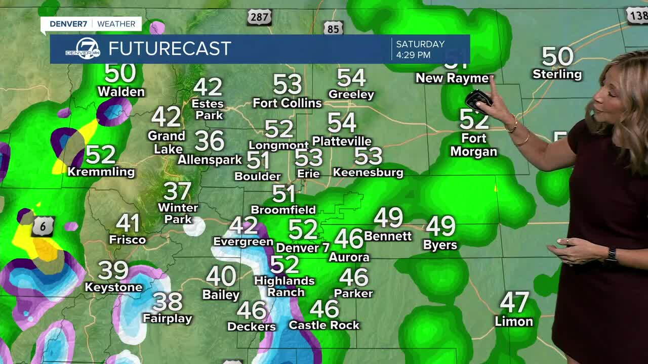
The bigger weather change arrives late tonight as a cold front pushes into northern Colorado. By Saturday, cooler air and breezy northerly winds will settle in behind the front, while southerly winds ahead of it help fuel showers and thunderstorms. A line of storms could develop along the front Saturday afternoon, with activity potentially spreading farther north into the later evening.
We'll see more rain and snow for the mountains both Saturday and Sunday. The cooler air will also drop mountain snow levels to around 9,000 feet. Expect scattered rain and snow showers in the high country through the weekend and possibly into Monday. Most mountain locations should see less than 2 inches of snow, although parts of the Mosquito Range could pick up more.
This cooler than normal weather will continue on Monday. It will be a chilly start on Monday morning, with overnight lows in the 30s! Temperatures will gradually climb through midweek as a ridge of high pressure builds back in. More 60s starting Tuesday!
Do you have a weather question for Lisa? You can email her at lisa.hidalgo@denver7.com and your weather question could be answered on air!
DENVER WEATHER LINKS: Hourly forecast | Radars | Traffic | Weather Page | 24/7 Weather Stream
Click here to watch the Denver7 live weather stream.
