DENVER — A cooler and more unsettled pattern will take hold tonight and continue through Friday, especially for areas east of the Continental Divide. A shallow cold front will push south this evening, ushering in cooler temperatures and increased low-level moisture. This frontal boundary will remain stalled near the Oklahoma border for much of the week, setting the stage for multiple rounds of afternoon and evening thunderstorms, mainly across the eastern plains and along the I-25 corridor.

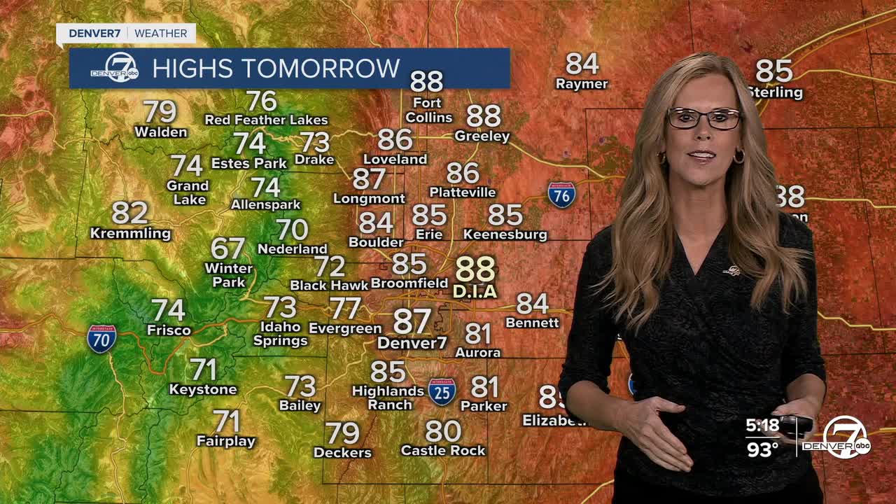
Starting Tuesday, expect widespread showers and thunderstorms to develop each afternoon, initiated over the mountains and spreading eastward. Lightning, gusty winds, and localized heavy rainfall will be the primary threats, particularly on Tuesday and Wednesday when moisture and instability are greatest. High temperatures will be noticeably cooler, with most areas across the plains seeing highs in the 80s. Heavy rain is expected with the showers and storms that do show up.

Wednesday continues the active pattern with stronger upslope flow, further enhancing storm coverage across the plains. Although storm organization will be limited by weak upper-level winds, localized flash flooding is possible in areas that receive heavier rainfall. Cloud cover and rain-cooled air will keep temperatures in the low to mid 80s for the plains and 70s to low 80s in the mountain valleys.
Thursday and Friday will bring more of the same, with high chances for afternoon storms and below-normal temperatures. A potential Denver Cyclone may focus storm activity across eastern portions of metro Denver and northeast Colorado. On Friday, a weak upper-level trough may enhance wind shear, creating a small window for stronger storms and possibly borderline severe weather, especially across the northeast corner.
Looking ahead to the weekend, conditions are expected to dry out and warm up. With the ridge shifting directly overhead, highs will climb back into the 90s for the plains and I-25 corridor, and storm chances will decrease significantly. By Sunday, most lower elevation areas have a good chance of reaching or exceeding 90°F.
DENVER WEATHER LINKS: Hourly forecast | Radars | Traffic | Weather Page | 24/7 Weather Stream
Click here to watch the Denver7 live weather stream.


