


DENVER — It's a clear and much calmer start to our day along the Front Range. We're still seeing some gusty winds across parts of Rocky Mountain National Park, but it's a lot calmer in the foothills and in areas west of Interstate 25.

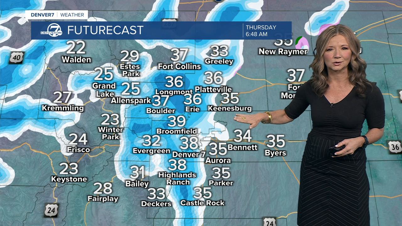
We'll see mostly sunny skies to start, with increasing clouds and highs in the upper 50s to low 60s across the Eastern Plains. Snow will develop in the mountains Wednesday night. That snow will spread east and we could even see a light rain/snow mix for the Thursday morning commute. We'll likely see a heavier round of snow Thursday afternoon into Thursday evening.
Temperatures will likely be in the 40s after midnight and then get colder as the day goes on. We'll see mid to upper 30s on Thursday afternoon, with potentially some slick roads for the Thursday evening commute.
Snowfall totals look to be around 2 to 4 inches for Denver, with up to 6 inches on the south and west sides of the metro area. Heavier snow is expected south from the Palmer Divide to Colorado Springs, where we could see around 5 to 10 inches of snow by noon on Friday.
Skies will rapidly clear out on Friday. We'll see mostly sunny skies late in the day, with highs in the low to mid 30s. It gets much warmer for the weekend. Highs reach the 40s on Saturday and low 50s on Sunday.
DENVER WEATHER LINKS: Hourly forecast | Radars | Traffic | Weather Page | 24/7 Weather Stream
Click here to watch the Denver7 live weather stream.
