


DENVER — Tonight will stay mostly quiet with clear to partly cloudy skies and comfortable temperatures. A weak weather system will slide through overnight, and a few isolated showers or thunderstorms may develop near the southern foothills and Palmer Divide. Any storms that do form could bring brief gusty winds.
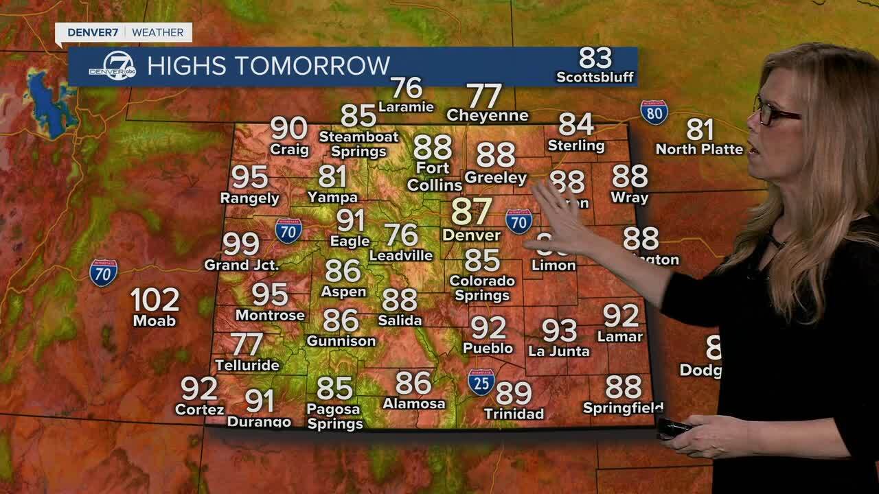
Friday looks warm, dry, and pleasant for most areas with plenty of sunshine. A few isolated afternoon showers or storms are possible near the foothills, but most locations will remain dry. Fire danger will stay elevated across the mountains and valleys due to dry conditions.

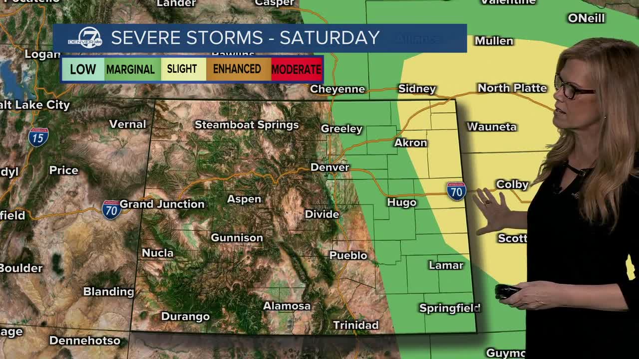
Saturday will be the most active weather day of the period. Critical fire weather conditions are expected in the mountains and mountain valleys, where warm temperatures, low humidity, and gusty winds will create dangerous conditions. Across the eastern plains, increasing moisture will set the stage for strong to severe thunderstorms during the afternoon and evening.
The strongest storms on Saturday could produce large hail, damaging wind gusts, and heavy rain, especially across the eastern plains. While the tornado threat appears lower, it cannot be completely ruled out. Anyone with outdoor plans should keep a close eye on the forecast.
Sunday and Monday will bring a return to more typical summertime weather, with scattered showers and thunderstorms developing during the afternoons and evenings. Some storms could still become strong at times, particularly over the plains. Cooler temperatures and continued chances for rain are expected to follow into the middle of next week.
- Watch the full forecast in the video player below.
DENVER WEATHER LINKS: Hourly forecast | Radars | Traffic | Weather Page | 24/7 Weather Stream
