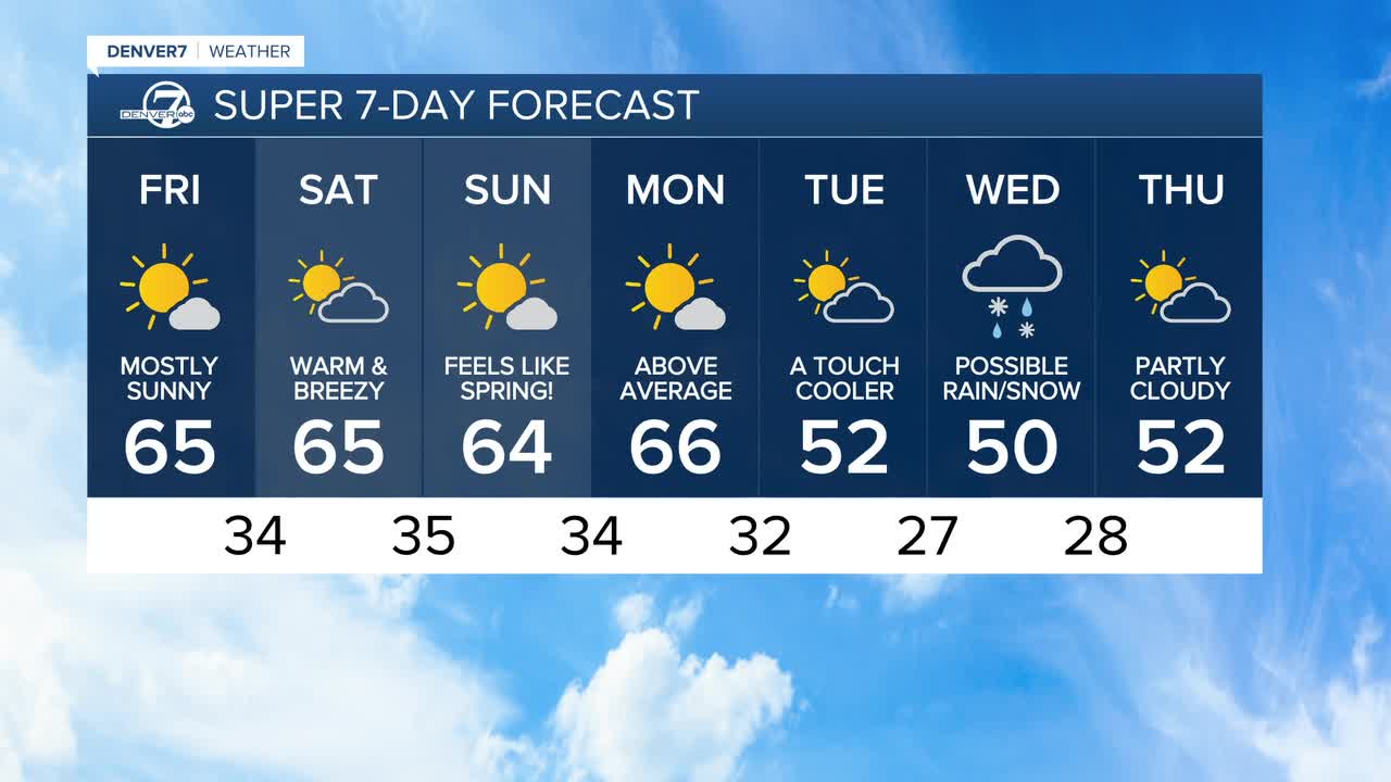


DENVER — The February heat is here! A ridge of high pressure is over Colorado, keeping conditions unusually warm and quiet across Colorado for the next few days.
Expect mostly sunny skies with dry conditions and afternoon highs climbing into the low to mid 60s on the plains, which is about 20 degrees warmer than what we’d normally see this time of year.
It’ll feel more like early spring than February, and that trend sticks around for a while. Friday brings plenty of sunshine and highs in the mid 60s along the I-25 corridor and onto the Eastern Plains.
Even though temperatures will be well above average, they should stay just shy of record levels for most spots, including Denver. Record highs are in the mid-70s through the weekend.
By Saturday, the warmth continues but the weather story shifts a bit with fire concerns. Dry air will push humidity values very low, and breezier winds, especially across the northern plains near the Cheyenne Ridge, could create high fire danger. It won’t be windy everywhere, but it’s a day to be extra cautious with anything that could spark a fire.
Sunday stays warm and dry with lots of sunshine. Then on Monday, another increase in winds combined with very low humidity could once again raise fire danger, particularly in the same northern areas.
Temperatures will still be running well above normal through the day before changes arrive Monday night.
Looking ahead to next week, a noticeable pattern change is expected starting Tuesday. Cooler, more seasonable temperatures should return as a more active weather setup brings several chances for precipitation. The best odds are in the mountains, where multiple light snow events could help a bit with drought conditions, while the plains may not see much moisture.
DENVER WEATHER LINKS: Hourly forecast | Radars | Traffic | Weather Page | 24/7 Weather Stream
Click here to watch the Denver7 live weather stream.
