


DENVER — Tonight will stay calm and comfortable with mostly clear skies and light winds. Temperatures will cool off nicely after sunset, and there may just be a few high clouds drifting through overnight. Overall, it’s a quiet spring evening with no major weather concerns expected.

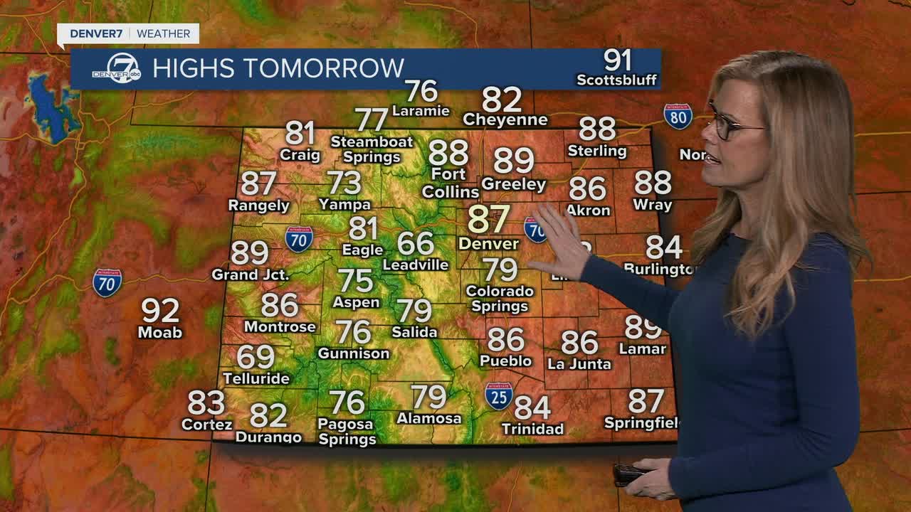
Monday brings a big warm-up and a much more summerlike feel across the area. Afternoon highs are expected to climb into the mid 80s for Denver and the lower elevations, which is well above normal for mid-May. Skies should stay mostly sunny, and winds will remain fairly light around the city, though gustier conditions in the mountains could increase fire danger there.

Tuesday stays warm, although a weak cold front may knock temperatures back just a little into the upper 70s and low 80s. There’s also a slightly better chance for a few afternoon showers or an isolated thunderstorm near the Front Range and foothills. Most places will stay dry, but you may notice a few more clouds compared to Monday.
The hottest part of the week looks to arrive Wednesday or Thursday. High temperatures are expected to reach the mid to upper 80s, and a few spots could even flirt with 90 degrees if everything lines up just right. Sunshine will continue to dominate, and the overall pattern still looks fairly dry for most neighborhoods.
By late week and next weekend, confidence in the forecast starts to drop a bit. Weather models disagree on how a storm system near California will move, so there’s still some uncertainty about whether we stay mostly dry or see better chances for rain. Right now, the most likely outcome is continued warm weather with only isolated showers and storms at times rather than any widespread soaking rain.
DENVER WEATHER LINKS: Hourly forecast | Radars | Traffic | Weather Page | 24/7 Weather Stream
Click here to watch the Denver7 live weather stream.
