


Colorado will see a major cooldown along the Front Range, continued mountain snow and intense wind gusts in an active weather day Sunday night into Monday.
After a break in the snow midday Sunday, another round of snow will move into Colorado's mountains through Monday. Winter Weather Advisories and Warnings continue for the northern and central mountains.

More mountain snow is expected Sunday night into Monday in the mountains with a slight chance of brief rain or snow showers in the metro as a cold front moves through the region Monday.
Winds will be very strong, with patchy blowing dust and elevated fire danger across the plains. A High Wind Warning is in effect for the plains for winds gusting as high as 80 mph. A Red Flag Warning for high fire danger is also in effect on Monday for the Front Range and SE Colorado.
⚠️⚠️We have upgraded to a HIGH WIND WARNING for Monday. ⚠️⚠️
— NWS Boulder (@NWSBoulder) December 29, 2024
Wind gusts up to 60 mph are expected for the eastern plains. Wind gusts up to 75 mph are expected for the foothills.
Gusty winds can blow around unsecured objects, cause power outages & make travel difficult. #cowx pic.twitter.com/tYe6DHyOBb
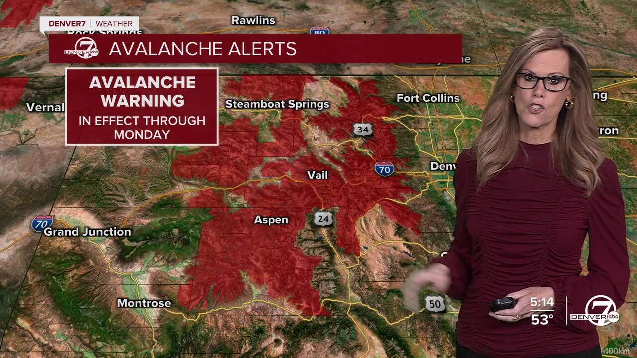
Avalanche danger is high for much of the high country, with waves of heavy snow and high winds. Please be extra cautious in the back country.
By mid-next week, snow chances decrease in the mountains. The plains and Denver cool down dramatically with highs only climbing into the 30s Tuesday. It will be dry, but very chilly for New Year's Eve celebrations.
Temperatures will be a bit more seasonal for New Year's Day in Denver, with highs in the low-40s. Warmer weather returns by the end of next week.

DENVER WEATHER LINKS: Hourly forecast | Radars | Traffic | Weather Page | 24/7 Weather Stream
Click here to watch the Denver7 live weather stream.
