


DENVER — Tonight, the storm over western Nebraska continues to move away, and mountain snow showers will wind down by around midnight. A few wrap-around showers will continue for the far northeast plains.
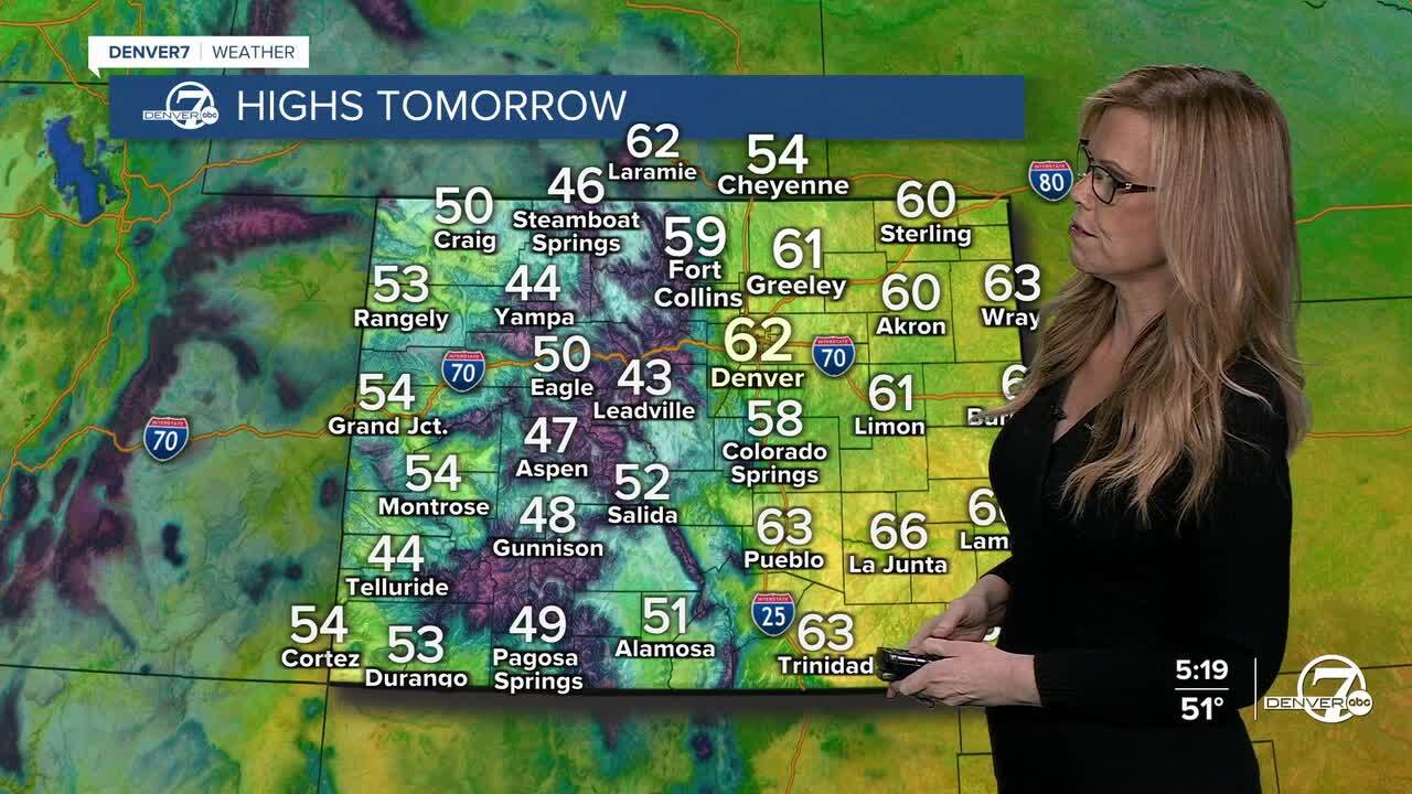
By late tonight and into Tuesday, an upper ridge moves in and clears things out. We’ll dry out again with highs in the upper 50s to low 60s across northeast Colorado, warmer than average for this time of year.

That ridge sticks around through Wednesday, so expect another quiet, mostly dry day. Maybe a light mountain snow shower or two, but temperatures stay 5–8 degrees above average.
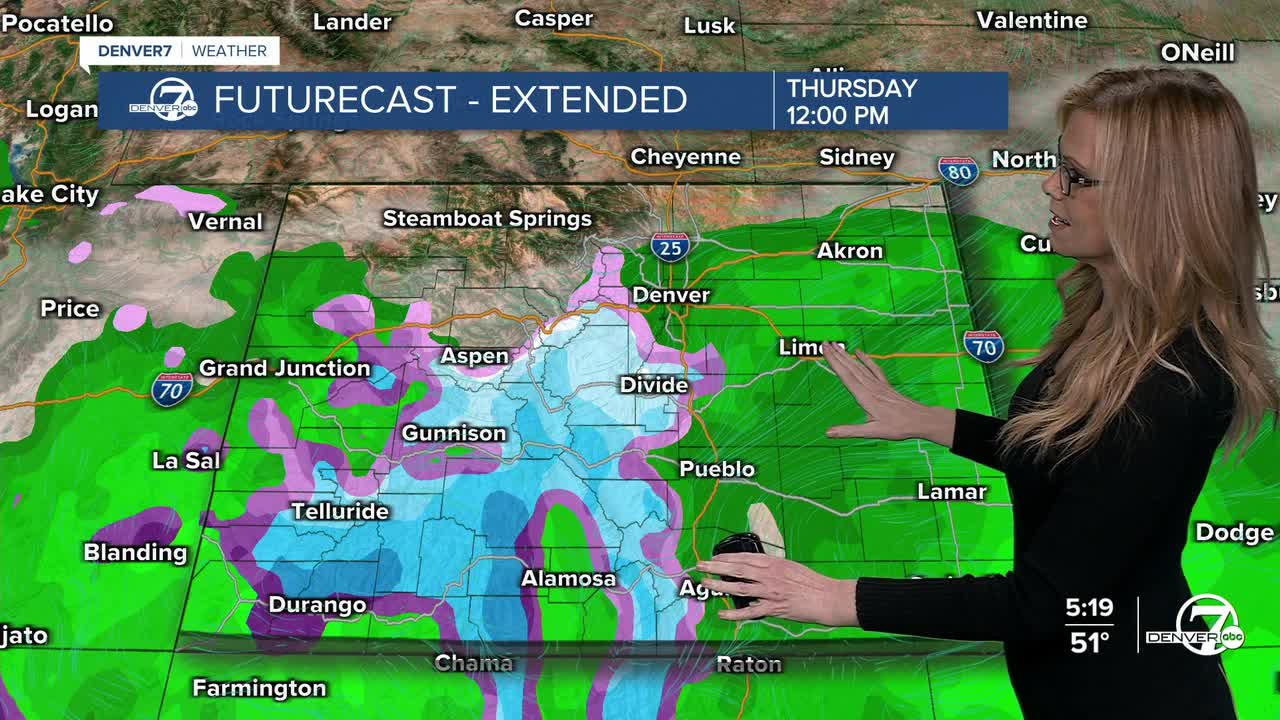
Our next storm arrives Thursday into Friday, and models now show better agreement. The system will likely be weaker as it moves in, but chances for measurable precipitation are increasing. Denver looks to see mostly rain, with a small chance of some light snow late Thursday night or Friday morning. Higher spots like the Palmer Divide have a better shot at accumulating snow.
Everything tapers off Friday as the storm drifts east and temperatures dip a bit below normal. By the weekend, another ridge builds in, bringing back dry weather and near-normal temperatures through early next week.
Keep your eyes on the forecast for Thanksgiving week- there is a huge batch of arctic air with its sights set on a large portion of the U.S. That means quite a few major cities- including Denver- could be in the deep freeze for Thanksgiving.
DENVER WEATHER LINKS: Hourly forecast | Radars | Traffic | Weather Page | 24/7 Weather Stream
Click here to watch the Denver7 live weather stream.
