


Tonight & Sunday:
We had a few showers and storms move across the eastern plains in the early evening- most of those have fallen apart. We will have partly cloudy skies overnight for the Denver metro area.

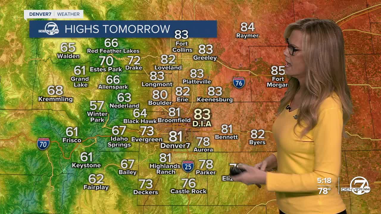
Sunday looks like the nicest day of the weekend, warm and mostly sunny with highs in the low 80s on the plains. There’s a small chance for afternoon showers or storms over the mountains again, and maybe a few drifting east, but nothing widespread.

Monday into Tuesday – Big Change Coming
A cold front moves in Monday, and that’ll bring a better chance for rain late in the day and into Tuesday. Expect cooler weather with highs dropping into the 60s. If you're in the high country (above 10,000 feet), there’s a good shot at some snow Monday night into Tuesday morning.

Tuesday stays cool with scattered showers around. It'll feel like fall — possibly even a bit of frost early Wednesday morning in the colder spots.
Late Week Outlook:
We’ll start to warm up and dry out again by Thursday as high pressure builds back in. Temperatures return to more typical early fall levels.
DENVER WEATHER LINKS: Hourly forecast | Radars | Traffic | Weather Page | 24/7 Weather Stream
Click here to watch the Denver7 live weather stream.
