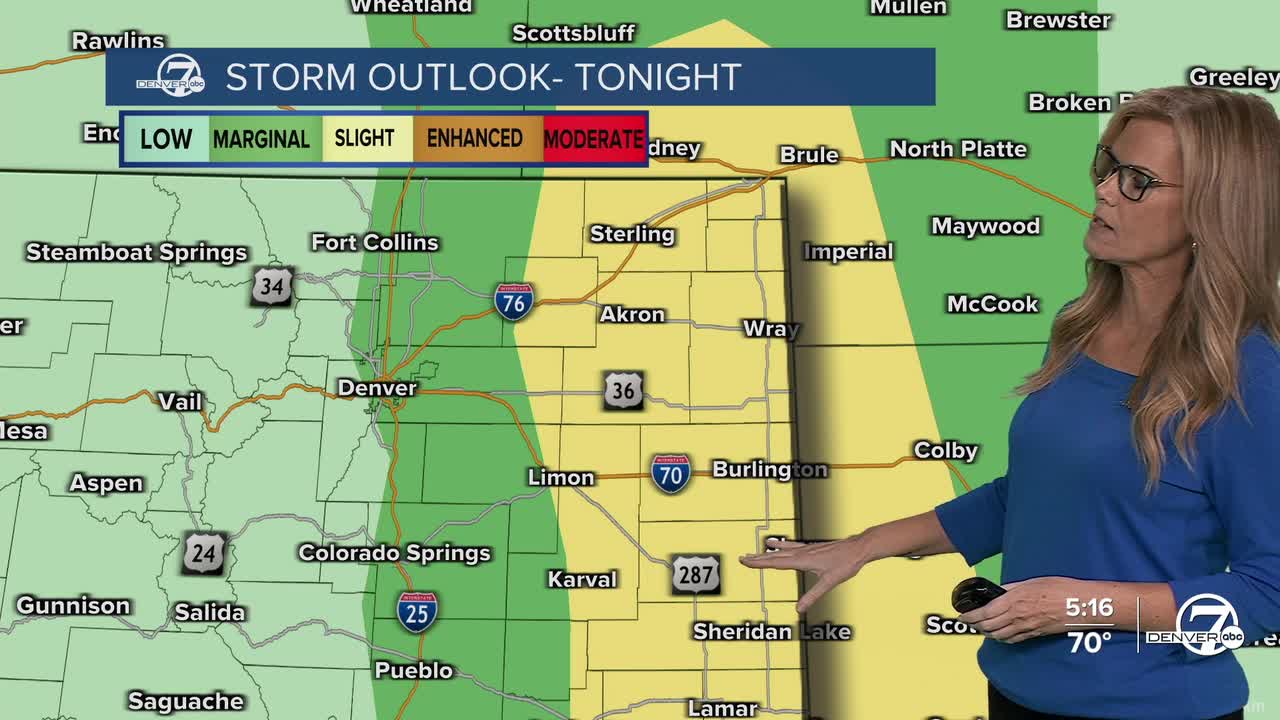


A dry cold front will move through early this morning, shifting winds around and dropping temperatures just a bit today. It’s not a dramatic cool-down, but you’ll probably notice a bit less humidity and more comfortable air, especially if you're out early. There’s a small chance for a stray storm in far northeastern Colorado, but most places should stay dry.

By Monday, things really start heating up. High pressure builds overhead, bringing dry, sunny weather and highs in the low to mid-90s across northeast Colorado. While there's still a little leftover moisture in far eastern parts of the state, it's not expected to do much, so Monday should stay storm-free for nearly everyone.

Tuesday and Wednesday crank up the heat even more, with highs pushing into the 100s for many areas. It’ll stay dry, windy at times, and unfortunately, that raises fire danger-especially in Jackson and Grand Counties. If you live or recreate in those areas, be especially cautious with anything that could spark a fire.
Looking ahead to the end of the week, there’s a bit of a pattern shift on the horizon. The heat may start to ease a bit by Friday or Saturday as the high-pressure system weakens and moisture slowly returns. That could mean some afternoon showers or storms popping up again as we head into next weekend, though timing and coverage are still a bit uncertain this far out.
DENVER WEATHER LINKS: Hourly forecast | Radars | Traffic | Weather Page | 24/7 Weather Stream
Click here to watch the Denver7 live weather stream.
