


Lather, rinse, repeat! Another round of rain is moving across the Front Range tonight with steady snow in the mountains!
The Denver metro area could see pockets of heavy rain late this evening with showers continuing throughout the overnight hours. The Front Range mountains will get another quick blast of snow tonight, but it looks to be much lighter than what we saw on Monday.
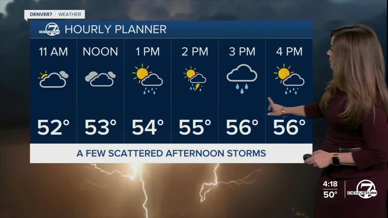
We'll wake up to some patchy fog and mostly cloudy skies Wednesday with morning lows in the lower 40s. Look for a glimpse of sunshine mid-morning with increasing clouds and storms after lunch. Storms will race across the Denver metro area and plains in the early evening hours and most move out of the area by 6pm. So far, it doesn't look like any cells will turn severe across Colorado.
Daytime highs will sit in the upper 50s to low 60s along the Urban Corridor Wednesday with slightly warmer weather on tap for the rest of the work week.
While we get a brief break from the wet weather Wednesday night into Thursday morning, more storms move back in Thursday afternoon along the Front Range. Highs will head into more seasonal territory, in the upper 60s to low 70s.
Look for mid-60s Friday with partly cloudy skies and a few isolated afternoon storms. So far, it looks like a much warmer and drier weather pattern takes over as we head into Memorial Day weekend.
We'll be in the 70s and low 80s Saturday and Sunday with mostly sunny skies - perfect weather to get outside! Right now, it looks like a few isolated storms are possible Monday afternoon but they shouldn't impact your outdoor plans too much. Stay tuned to the Memorial Day forecast as it gets a bit closer.
DENVER WEATHER LINKS: Hourly forecast | Radars | Traffic | Weather Page | 24/7 Weather Stream
Click here to watch the Denver7 live weather stream.
