


DENVER — Afternoon highs were in the 60s across most of the Front Range on Friday. We will be warming up this weekend into the 70s for Saturday and Sunday.
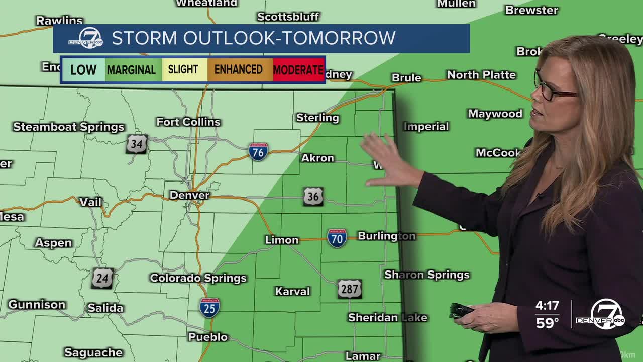
On Saturday expect partly cloudy skies with chances for isolated storms in the afternoon and evening. We aren't expecting a wash-out, more of the garden variety scattered showers. Heavier rain is possible across the eastern plains toward Burlington and Wray.
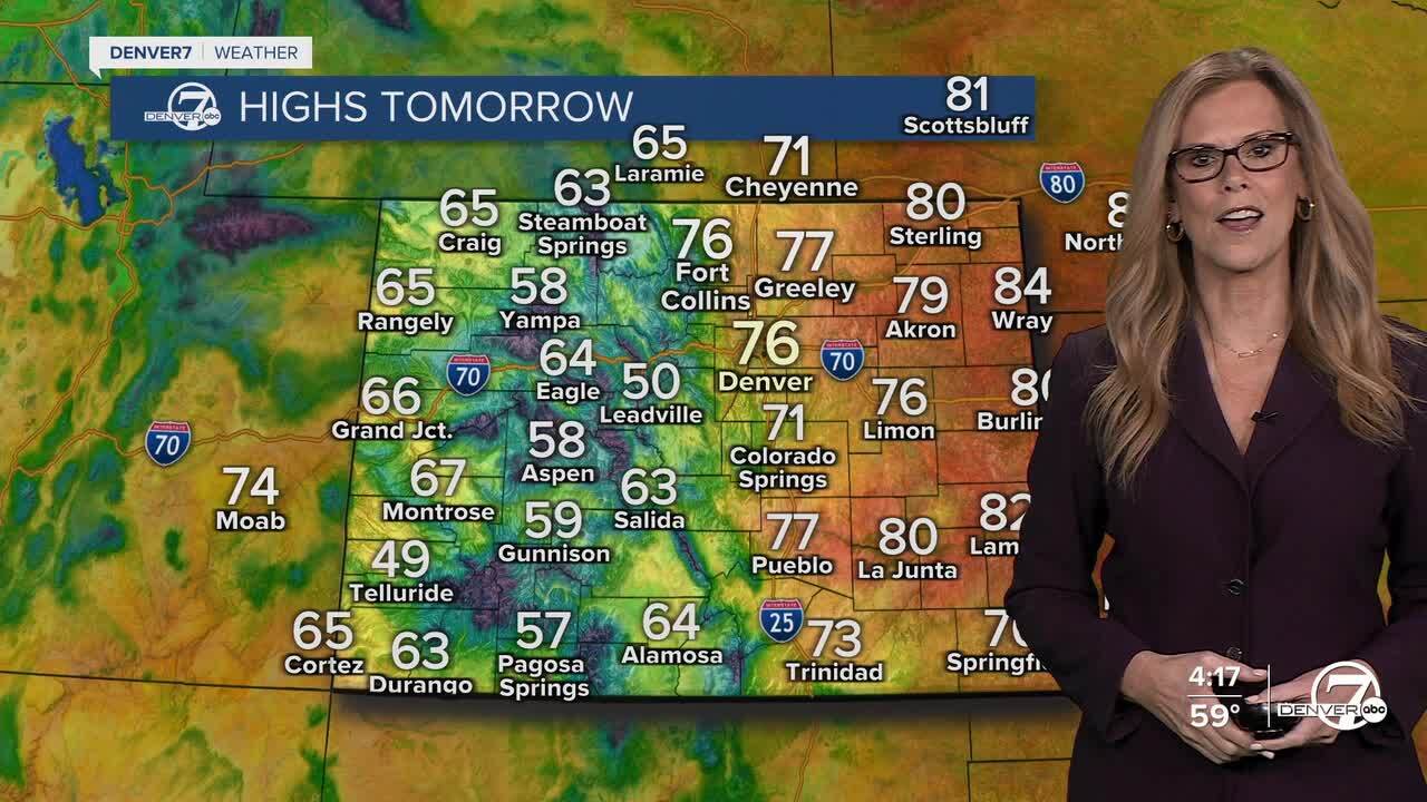
By Sunday, conditions shift to warmer and much drier weather. Sunshine will return, and temperatures will climb above normal for this time of year. However, breezy to windy conditions are likely to develop, especially in the afternoon, which combined with the dry air will increase fire danger across the region.
This warm, dry, and somewhat windy pattern continues into Monday. Fire weather conditions may become more concerning as humidity levels drop further and winds stay elevated, particularly across open plains and southeastern areas. We have a Fire Weather Watch in effect for eastern Colorado on Sunday.
DENVER WEATHER LINKS: Hourly forecast | Radars | Traffic | Weather Page | 24/7 Weather Stream
Click here to watch the Denver7 live weather stream.
