


DENVER — Severe storms will pop up along the Urban Corridor this evening, bringing the potential for large hail and damaging winds. The storms move out around 10pm leaving behind mostly cloudy skies. Overnight lows will dip into the low to mid 50s by Friday morning.
- Watch Danielle Grant's full forecast in the video player below.
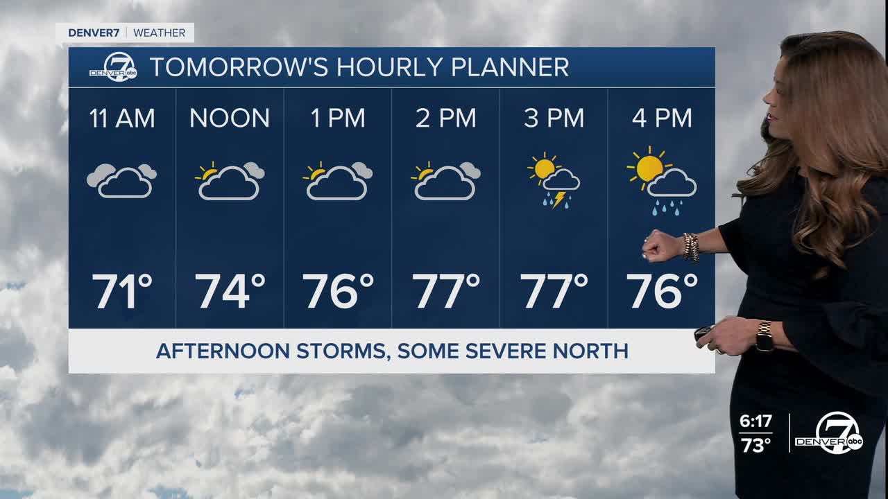
It'll be a mostly cloudy start to your Friday with a bit of sunshine popping out midday. Look for another round of storms moving into the Front Range around 3pm continuing through the dinner hour.
Friday's marginal risk of severe weather will cover the far northeastern corner of the state. Large hail and damaging winds will be the biggest threats but we can't rule out an isolated tornado or two.
It'll be a bit drier over the weekend with just a few storms possible on Saturday and Sunday. We could see a few severe storms pop up Saturday afternoon along the far northeastern plains. Daytime highs will be seasonal in the upper 70s to low 80s this weekend.
The seasonal but unsettled weather pattern will continue into early next week, the first week of June. So far, it looks like a summer-like heat wave moves into the Denver metro late next week with highs in the upper 80s.
DENVER WEATHER LINKS: Hourly forecast | Radars | Traffic | Weather Page | 24/7 Weather Stream
Click here to watch the Denver7 live weather stream.