


DENVER — It's a gorgeous start to the day! We'll see lots of sunshine to start, with temperatures in the 40s and 50s for your morning drive.

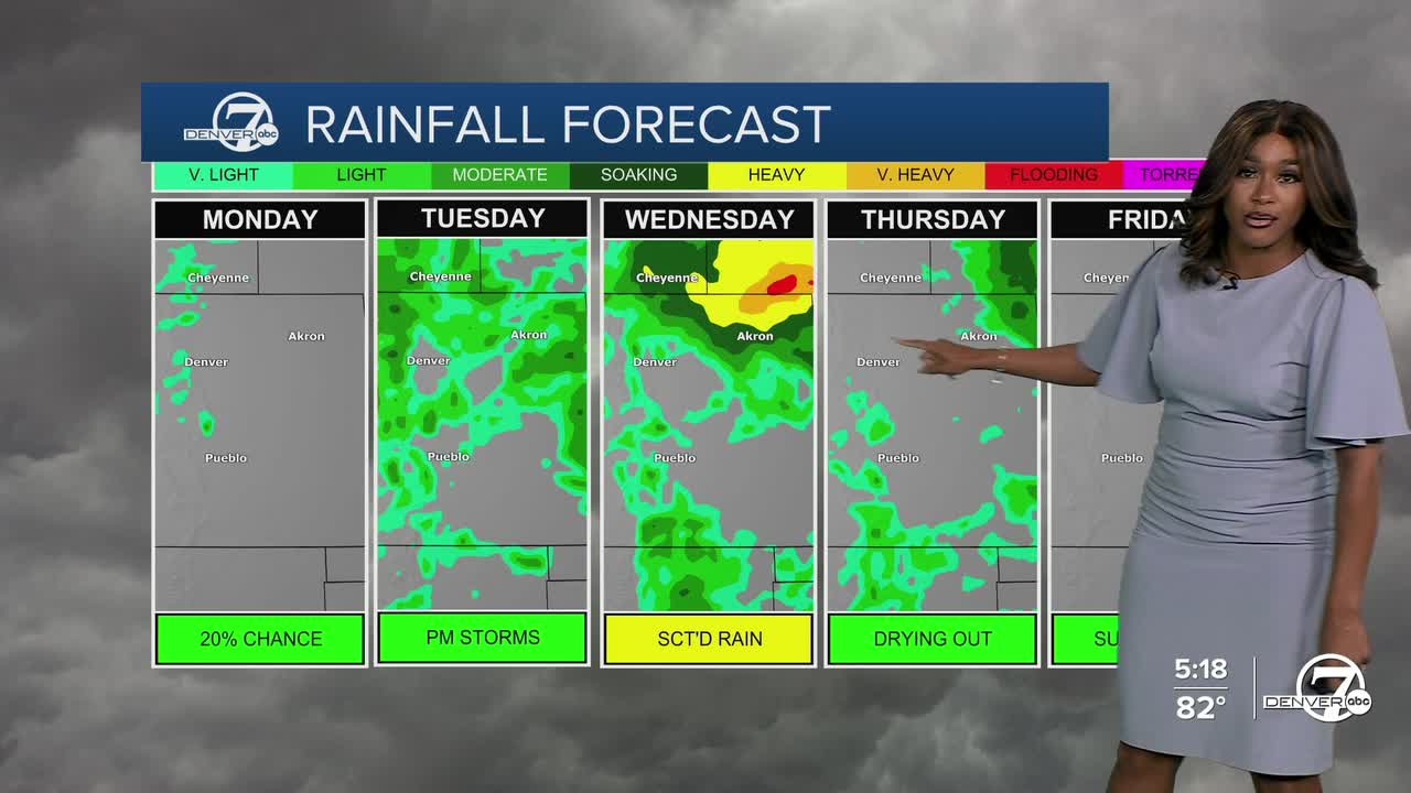
Monday is shaping up to be a really nice day across most of Colorado. We’ll see sunshine on the plains most of the day, with just a slight chance of isolated storms. Highs will climb into the low to mid 80s, making it feel like a solid late-summer day.
Things start to change again Monday night into Tuesday. A cold front will drop down from the north, bringing cooler temperatures and increasing the chances for scattered showers and thunderstorms by Tuesday afternoon. The unsettled weather is tied to an upper-level low pressure system that will slowly move across Wyoming and into eastern Colorado.
We'll see more scattered showers and an even bigger cool down by mid-week. Temperatures will climb into the mid-70s on Tuesday, but will be about 10 degrees cooler on Wednesday. Highs only reach the 60s!
Looking ahead to Thursday and beyond, the forecast gets a little murky. There’s still some uncertainty in how the pattern will play out. A ridge of high pressure is expected to build to our west, while that same low lingers just east of Colorado. This setup suggests that Thursday will likely stay on the cooler and cloudier side, with the chance for a few more storms. It does look like things will gradually clear up and warm up by Friday, with more low 80s through the weekend.
DENVER WEATHER LINKS: Hourly forecast | Radars | Traffic | Weather Page | 24/7 Weather Stream
Click here to watch the Denver7 live weather stream.
