


Tonight, we’ll see a few showers and storms hanging around, mainly over the mountains. There’s a slight chance a storm or two could drift off the mountains and into the lower elevations, but they’ll likely fizzle out as they move east. With some clouds sticking around overnight, it’ll stay a bit warmer than last night.

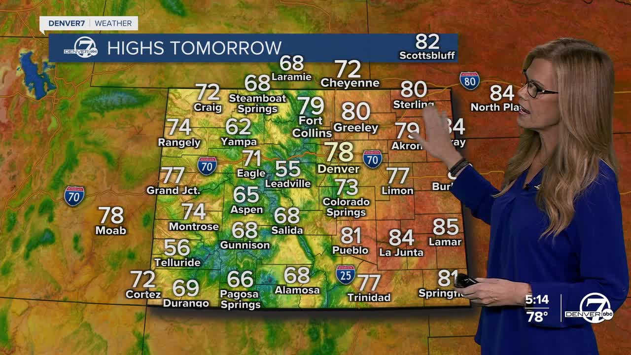
Tomorrow (Monday) looks like our best shot at some more widespread rain. A slow-moving weather system will finally pass through Colorado, bringing a better chance of showers and a few thunderstorms, this time even for the lower elevations. We're expecting quick moving showers that will mostly be light.

Tuesday cools off a bit in terms of activity, with just a few spotty showers or weak storms over the higher terrain in the afternoon. Most places will stay dry, and temperatures will continue to run a bit warmer than usual for this time of year.
By midweek, the weather turns even quieter and warmer. We’ll see more sunshine and rising temps, with Thursday shaping up to be the hottest day of the week, highs could reach the mid to upper 80s on the plains. It’ll feel more like summer than fall for a few days.
Looking toward the weekend, some changes are brewing. A new weather system could bring more clouds, cooler air, and maybe even a bit of moisture. It’s still a little early to know exactly how it’ll play out, but we may be in for a shift back to more fall-like weather by the end of the week.
DENVER WEATHER LINKS: Hourly forecast | Radars | Traffic | Weather Page | 24/7 Weather Stream
Click here to watch the Denver7 live weather stream.
