


DENVER — Tonight will stay fairly mild with temperatures dropping into the 40s and low 50s across lower elevations. A few isolated showers or weak storms could still pop up through the evening, mainly near the mountains and far northeast Colorado. A couple storms in the northeast corner could turn strong with gusty winds and hail possible before things quiet down overnight.

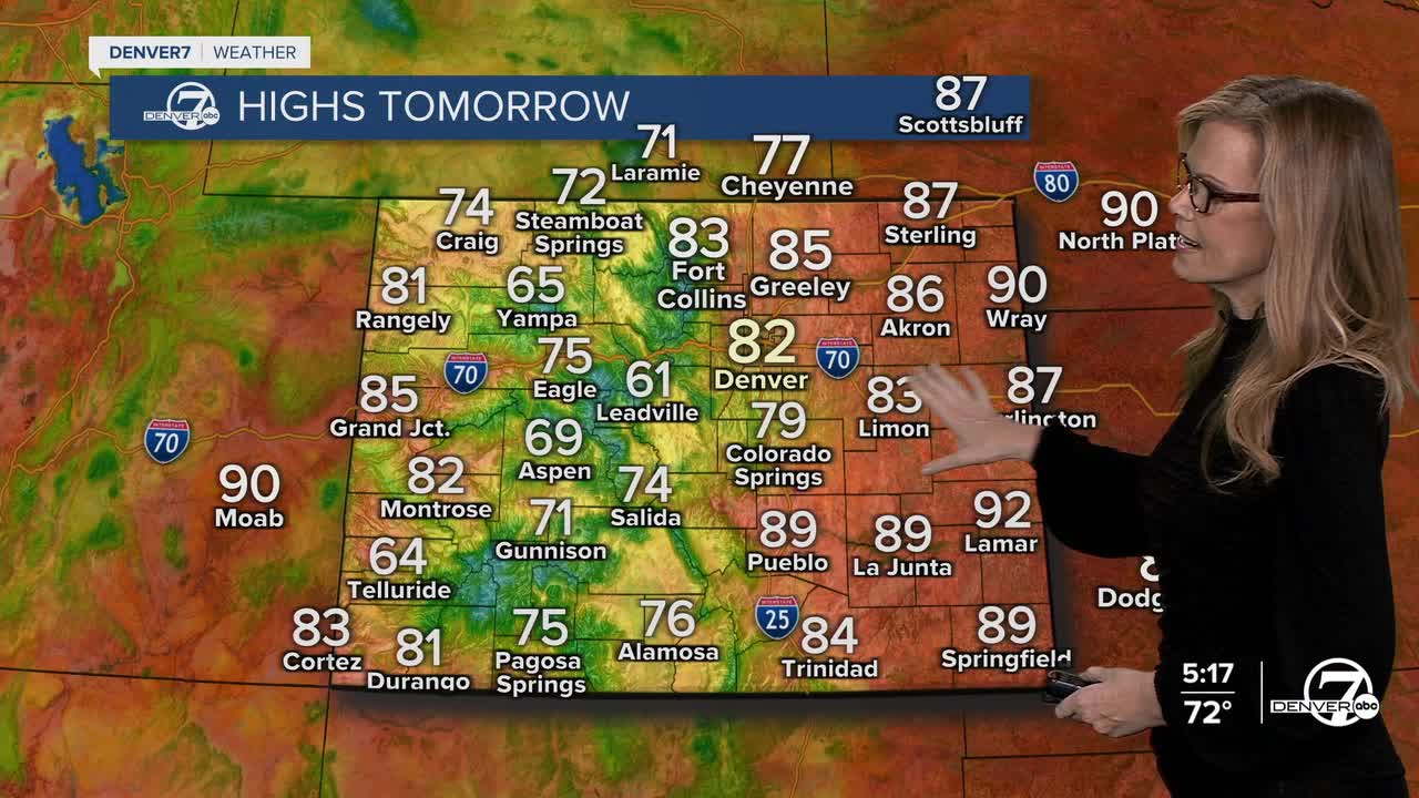
Sunday brings a noticeable warm-up with mostly dry conditions across the state. Highs will climb into the 80s along the Front Range and could push close to 90 degrees out on the northeast plains. A few spotty afternoon showers or weak thunderstorms may develop over the mountains, but most areas should see a sunny and warm day.

Monday looks like the warmest day of the week with temperatures running well above normal. Afternoon highs across the plains could end up 10 to 15 degrees warmer than average for late May. As moisture slowly increases, scattered afternoon and evening showers and thunderstorms will begin to develop more regularly, especially over the mountains before drifting onto the plains.

By Tuesday and Wednesday, the weather pattern turns a bit more active. Temperatures will stay mild, but daily chances for afternoon and evening showers and thunderstorms are expected across much of Colorado. Storms should remain fairly typical for this time of year, with brief heavy rain, lightning, gusty winds, and small hail all possible.
Toward the end of the week, scattered showers and thunderstorms continue as a slow-moving weather system lingers to the west. Temperatures should settle closer to seasonal averages, keeping afternoons warm but not excessively hot. Overall, expect a mix of sunshine each morning followed by developing clouds and storm chances later in the day.
DENVER WEATHER LINKS: Hourly forecast | Radars | Traffic | Weather Page | 24/7 Weather Stream
Click here to watch the Denver7 live weather stream.
