DENVER — Our streak of no snow has been broken in Denver with 0.2 inches having fallen Saturday morning at Denver Int'l Airport. The mountains had 5-10 inches of snow...and more is on the way for Sunday.
We are settling into the coldest stretch of the season so far. Many spots will fall into the single digits early Sunday- with our wind chills below zero. Either way, expect a very chilly morning with Sunday staying just as cold, with highs only in the 20s and low 30s.

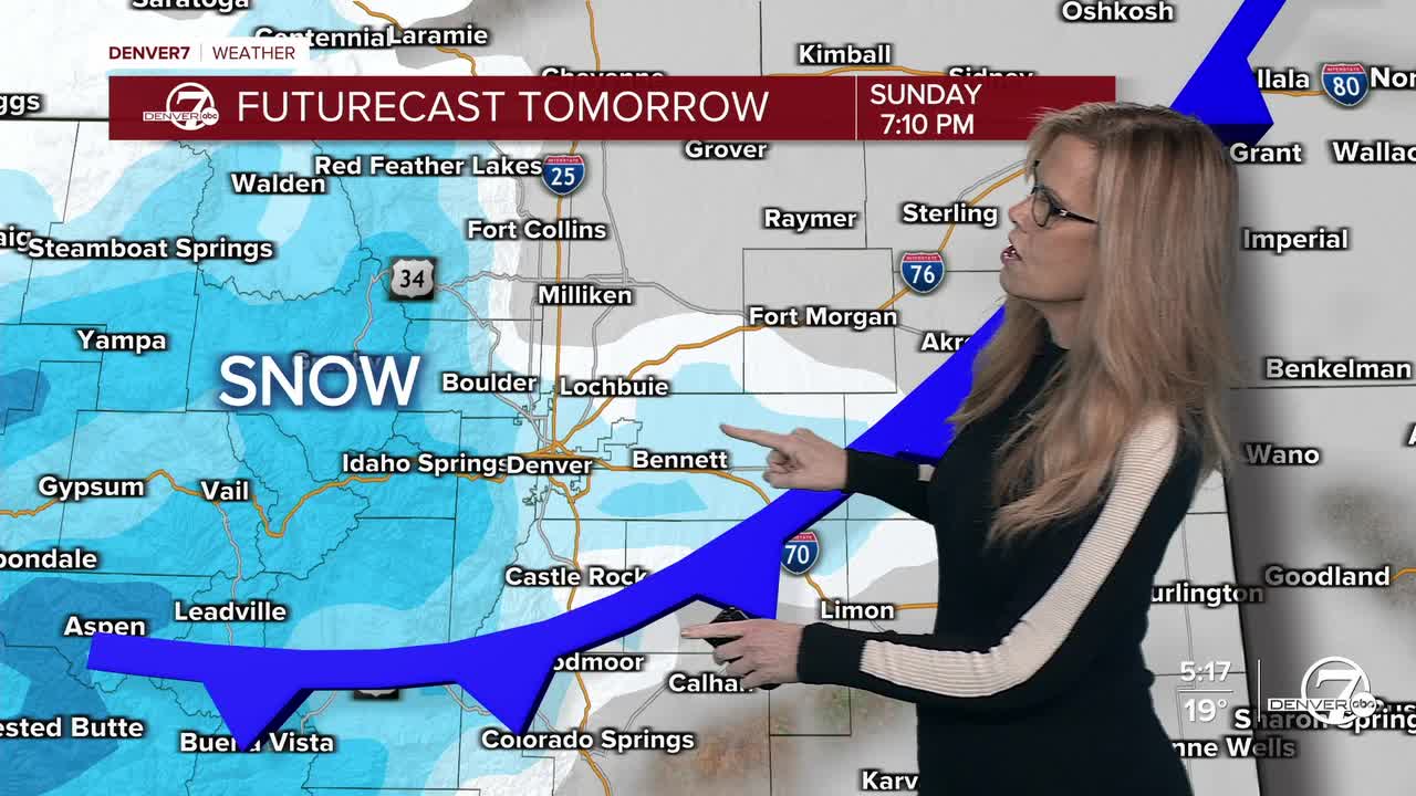
As we head through Sunday and into Sunday night, another fast-moving storm system will sweep in from the northwest. This one brings a solid chance for light to moderate snow in the mountains, where 4–10 inches are expected on the favored slopes. Lower elevations, including the Denver metro, may also see some snow, but amounts should stay on the lighter side. Still, a quick inch isn’t out of the question if a narrow band sets up over the I-25 corridor.

Monday brings a small break. The storm will race off to the east, and temperatures will warm just enough to nudge above freezing. It won’t exactly feel warm thanks to a lingering northerly breeze, but at least we’ll get some sunshine back. Tuesday looks mostly dry and slightly milder as well, though the mountains may pick up a few light snow showers late in the day.
Things get more interesting again Wednesday into Thursday as another system develops over the Rockies. Forecast models are still trying to pin down its exact track, but there’s a decent chance for some wintry weather to return, possibly even to the lower elevations this time. About a quarter of model solutions show measurable snow for the Denver area, so it’s something to watch, especially for midweek travel. Mountain areas, as usual, have the higher confidence for impacts.
Toward the end of the week, the overall pattern looks colder and somewhat unsettled, with occasional systems brushing the region. Winds may pick up at times, and temperatures should bounce around but stay close to seasonal norms. Precipitation chances become more uncertain, but the door remains open for additional light snow chances as we roll into next weekend.
.
DENVER WEATHER LINKS: Hourly forecast | Radars | Traffic | Weather Page | 24/7 Weather Stream
Click here to watch the Denver7 live weather stream.


