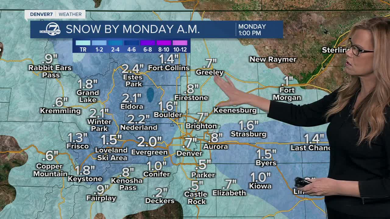


Starting late tonight, we’re looking at a period of light snow moving into the area and sticking around through the overnight hours into early Monday morning. This won’t be a big storm, but it should be widespread enough to cause slick roads, especially for Monday morning. Most lower elevations, including the Denver metro and eastern plains, can expect about half an inch to maybe two and a half inches of snow, which is just enough to slow things down.

Because of the fresh snow and some clearing skies, Monday will stay on the chilly side. High temperatures will run below normal, and there’s a chance Denver doesn’t even make it into the 40s during the afternoon. Roads should improve later in the day, but the morning drive could be messy, so give yourself some extra time.

Looking ahead, things calm down nicely from Tuesday through Thursday. A brief break in the active weather sets up with generally dry conditions and more sunshine. That said, Tuesday could turn very dry and breezy, especially across the foothills and northeast plains. Winds could gust over 35 miles per hour, and if we don’t get enough moisture from tonight’s snow, fire danger could briefly become a concern.
A weak system slides through Tuesday night into Wednesday, bringing a cold front and gusty winds. Temperatures will dip slightly below normal on Wednesday, but at this point, any snow looks spotty and light if it happens at all. It’s something we’ll keep an eye on, but it doesn’t appear to be a major player right now.
By late Friday and into next weekend, a sharper blast of cold air is expected to arrive in Colorado. This looks like a brief cold outbreak, with overnight lows possibly dropping into the single digits or even below zero on the plains. There’s also a chance for some light snow, especially along the southern foothills, as that colder air settles in to wrap up the week.
DENVER WEATHER LINKS: Hourly forecast | Radars | Traffic | Weather Page | 24/7 Weather Stream
Click here to watch the Denver7 live weather stream.
