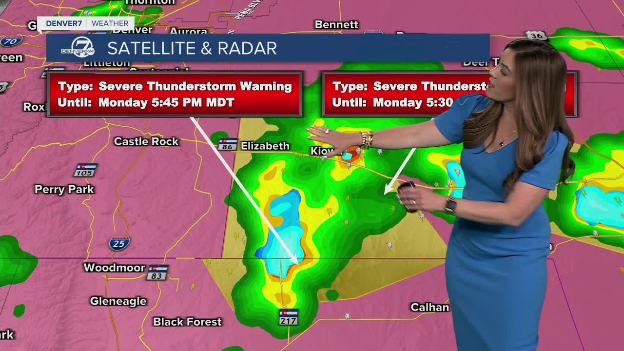


DENVER — Strong storms are still rumbling across Eastern Colorado tonight after delivering huge hail to parts of the Denver metro area earlier this afternoon.
- Watch the full forecast in the video player below.
Look for partly cloudy skies overnight along the Urban Corridor as temperatures dip into the lower 50s.
Lather, rinse, repeat! We're in for some sunshine early Tuesday morning with increasing clouds by the afternoon. Daytime highs will top out in the upper 70s to low 80s and that's pretty close to our seasonal norms for early June. Another round of storms will move across the Interstate 25 corridor around 2pm to 3pm and then move east. The far Eastern Plains are under a marginal threat for a few severe storms, ushering in another round of heavy rain, lightning and large hail.
We're in for a few more afternoon storms on Wednesday and Thursday before drier and warmer weather start to push into the state. A ridge of high pressure will strengthen by Friday and bring some serious summer-like heat to the Front Range!
Denver could see its first 90-degree day of 2026 this Saturday and the sizzling hot temperatures and sunshine stick around Sunday. Stay cool, Colorado!
DENVER WEATHER LINKS: Hourly forecast | Radars | Traffic | Weather Page | 24/7 Weather Stream
Click here to watch the Denver7 live weather stream.